
Joshua Tree National Park - April 2010
We began our adventure by visiting our good friends, Jim and Susan, at their home in Riverside. We drove from there to the Joshua Tree National Park for four days of exploration, taking a morning diversion one day to visit the General George S. Patton Jr. Memorial Museum at Chiriaco Summit. Jim and Susan joined us for the first two days of our exploration, and we stayed in the little town of Joshua Tree to the north of the park. We then drove to the Owens Valley where we stayed for two of the three planned days in Lone Pine until we had to beat a hasty retreat home when a late snow storm threatened to trap us there. All told, we covered 1,629 miles in 10 days.
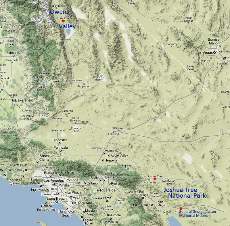
Map of Southern California from Owens Valley to Joshua Tree National Park, covering the range of this trip. (Map from Google.)
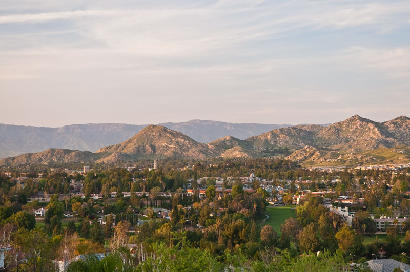
This image was taken from the hill above our friends' home at sunset looking north over the University of California, Riverside. Immediately behind the campus are the Box Spring Mountains and in the background are the San Bernardino Mountains.
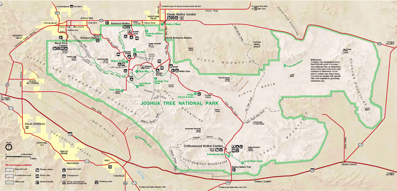
We first entered Joshua Tree National Park (http://www.nps.gov/jotr/) from the south on I10 turning onto Cottonwood Springs/Pinto Basin Road and drove north through the park. The NPS Joshua Tree National Park map page is here: http://www.joshua.tree.national-park.com/map.htm (where you can actually read it and make out the details) and displayed above.
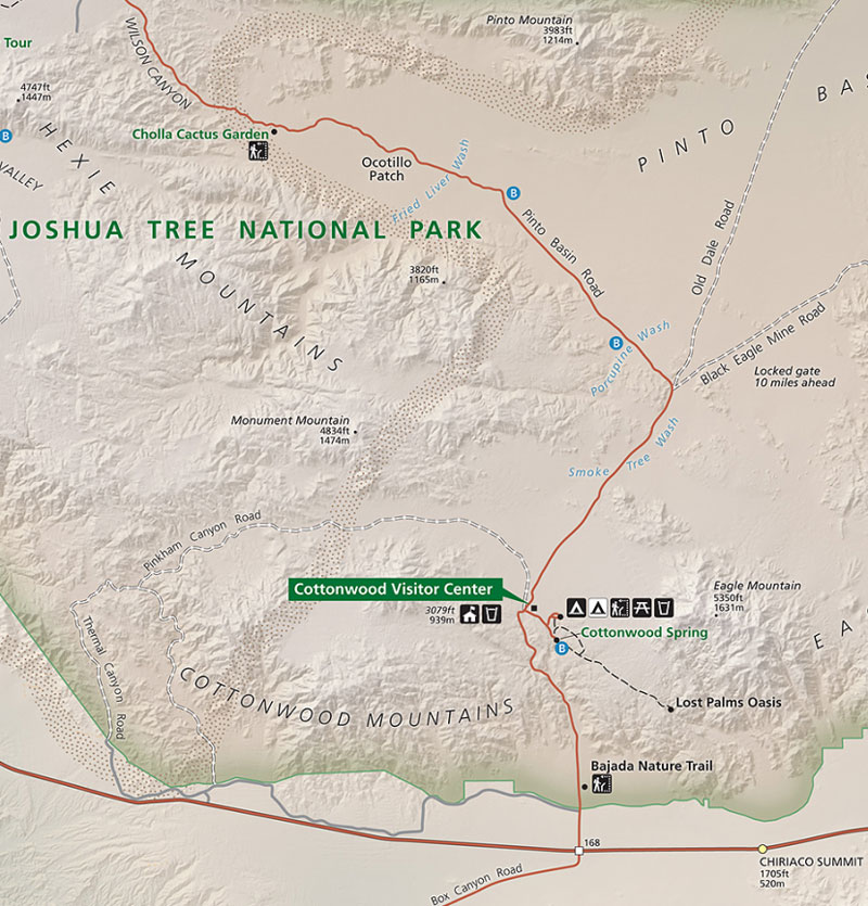
Note that the southern part of the park is in the Colorado Desert and one passes through a transistion zone (marked by a band of brown dots in this south-central detail of the NPS map below) into the Mojave Desert as one moves north and climbs in altitude.
Here we're looking north up at the pass through the Cottonwood Mountains from the Cottonwood Springs Road.
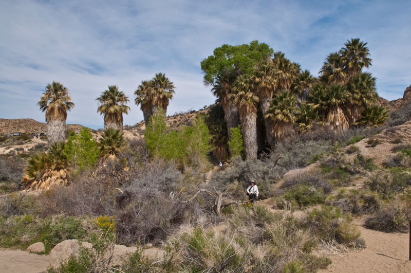
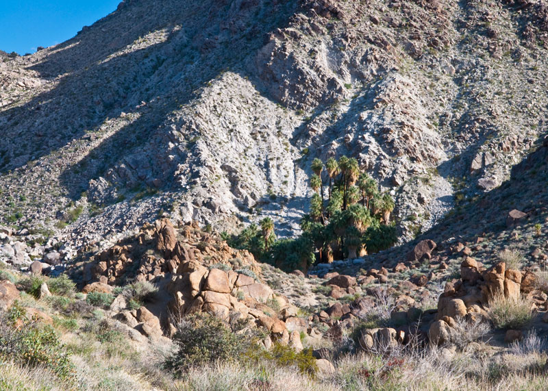
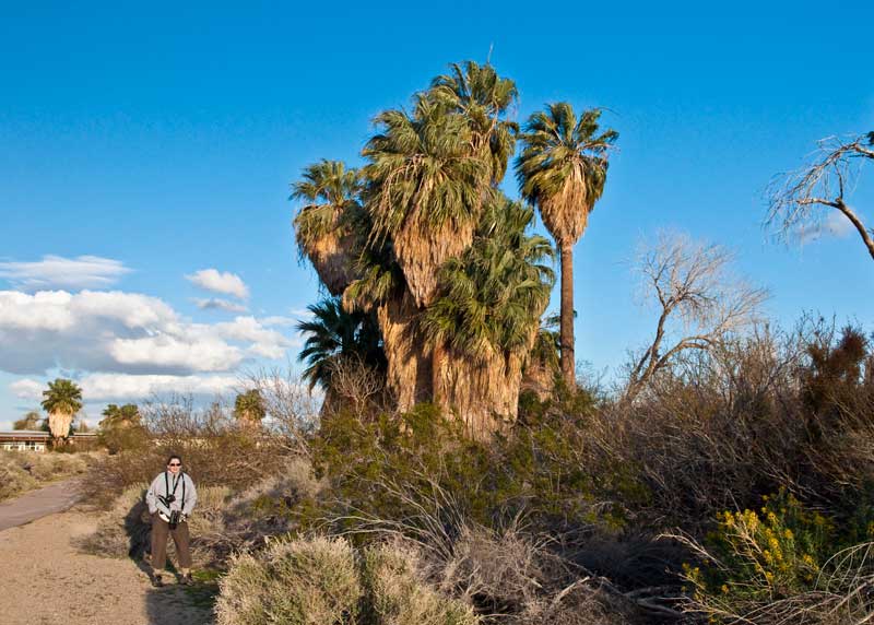
This is the Cottonwood Spring Oasis (http://www.nps.gov/jotr/planyourvisit/cottonwood.htm) located about 7 miles north of the park's south entrance near the Cottonwood Vistor Center. The oasis exists here due to a fault that allows water to seep to the surface thus sustaining the growth of dense flora. The palms are the California Fan Palm (washingtonia filifera) that can grow to 60 feet in height. Oases such as this are found in many places throughout the park and in surrounding areas, giving "palm" names to many locales, e.g. Palm Springs, Twentynine Palms, Fortynine Palms, etc. The cottonwood trees that give their name to this oasis can be seen amongst the fan palms, the bright green trees in the center-left of the photo.
The Colorado Desert at Cottonwood Spring. The rock outcroppings are solidified plutonic lava (solidified below the surface and exposed by weathering of the surface rock) called monzogranite. In the foreground are several yucca plants and in the middle distance are numerous cholla.
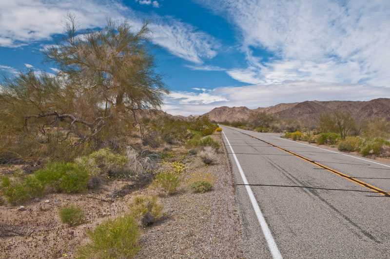
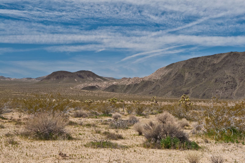
After crossing the Cottonwood Mountains we entered the Pinto Basin. Pinto Mountain (3983 ft.), left of center, and the Pinto Mountain Range are seen in the distance on the north side of the basin. The transition zone into the Mojave Desert runs along the side of the Pinto Mountain Range. Yucca, creosote and other scrub bush dot the landscape.
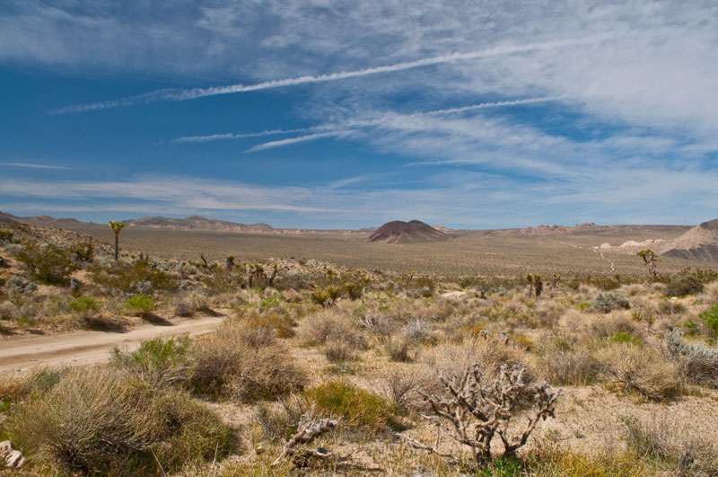
Smoketree (psorothamnus spinosus), in the foreground, creosote and cholla dot this wash in the Pinto Basin. The Eagle Mountains are in the right background, and the Coxcomb Mountains are in the extreme center horizon.
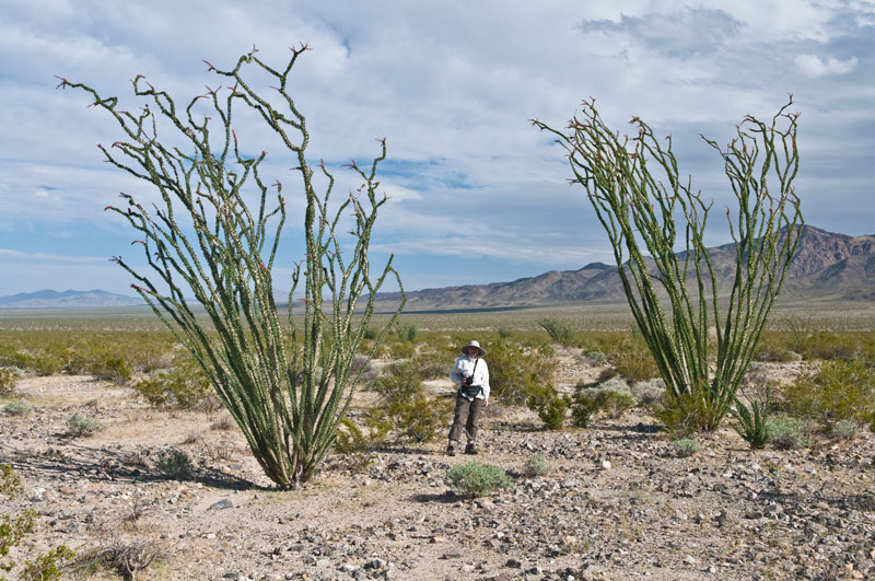
Ocotillo (fouquieria splendens) is a succulent common to the Colorado Desert of California. Brilliant red flowers bloom in 10" clusters on the ends of the branches. The Pinto Basin stretches beyond the ocotillo.
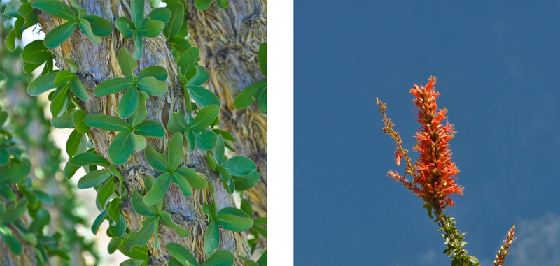
Close ups of the leaves along the Ocotillo trunks and their flowers that appear in spring after good rains. These photos were taken by Denise.
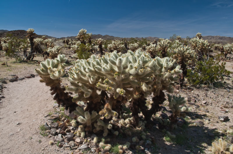
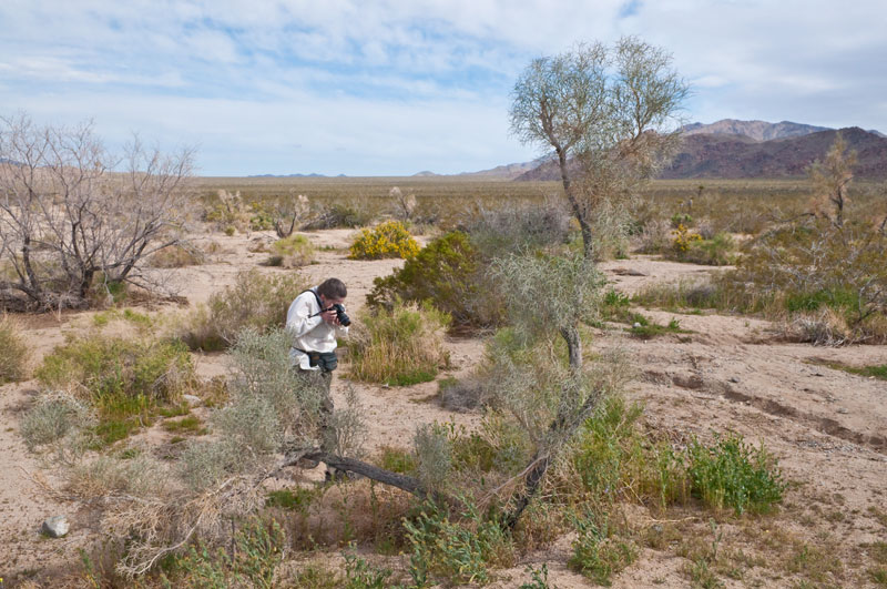
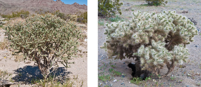
The Cholla Garden is located on the Pinto Basin Road just as one enters the transistion zone between the Colorado and Mojave Deserts. This forest of "Teddy Bear" Cholla (Cylindropuntia Bigelovii) forms a band at the base of the transistion zone. Its name derives from its fuzzy-like appearance. There is a quarter mile nature hike that meanders through the Cholla Garden, but one must proceed with extreme care. The Cholla "stems" are covered with fine spines that are barbed at the end and that will grab ahold of anyone or anything that accidentally brushes against them. The stems easily detach and will hitch a ride on ones clothing or in ones flesh (of which I have some personal experience). Most of the cholla in this forest are clones grown from stems that were carried away by animals. Note the yellow-green blossoms on the end of the some of the stems.
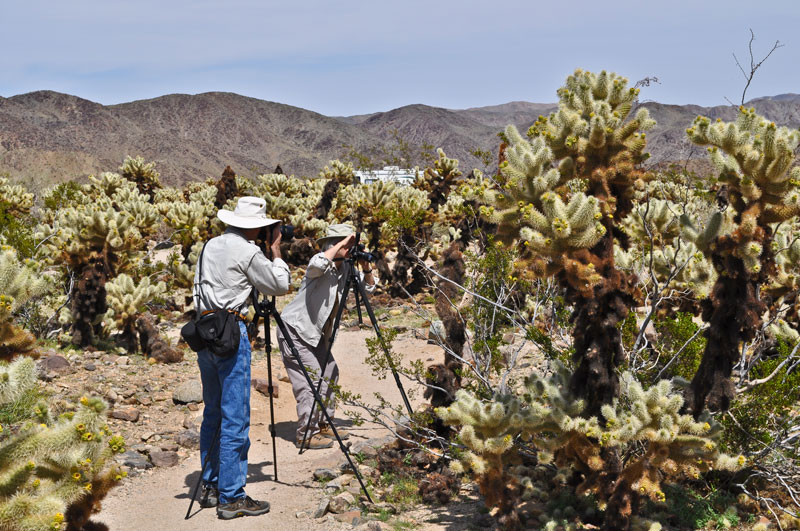
The danger of accidentally bumping into a cholla are evident in this photo of our friend Susan and me practicing the fine art of photography. The nature trail is quite narrow in some places where the cholla has overgrown it. This photo was taken by Denise.
![]()
![]()

After driving north through the transistion zone we entered the Mojave Desert. Below is a northwest detail of the NPS map. We stayed in the little town of Joshua Tree located on Highway 62 (also known as Twenynine Palms Highway) near the west entrance to the park. All areas within the park were easily accessible from Joshua Tree. Similarly, the town of Twentynine Palms would be a good place to stay in future visits.
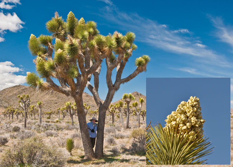
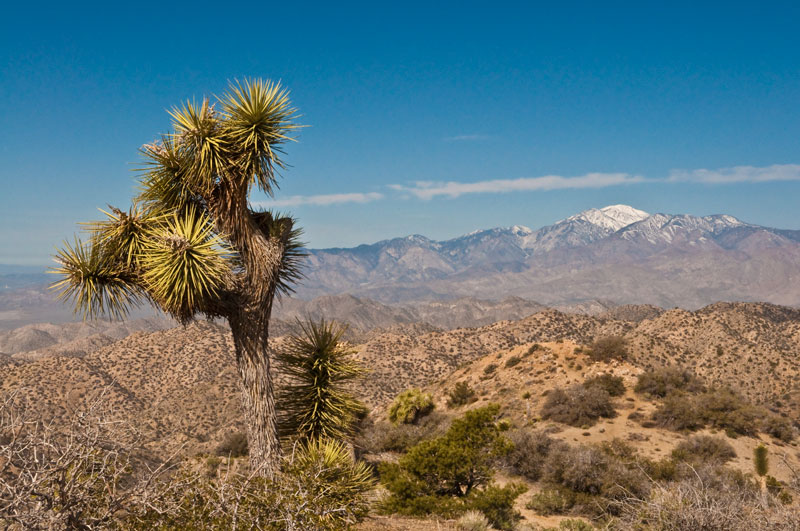
The Joshua Tree (yucca brevifolia), from which the park gets its name, is an indicator species of the Mojave Desert. By legend, it got its name from 19th century Mormon settlers who were reminded of the biblical Joshua raising his arms towards the sky in supplication. Note the yellow-white blossom panicles at the ends of some branches. A winter freeze that damages the growth end of a branch is believed to stimulate flowering, followed by branching. Thus a Joshua Tree composed of a single trunk and no branches presumably has never blossomed. The largest Joshua Tree in the park stands 40 feet tall and is believed to be 300 years old. (The detail of the blossum panicle, inset, was taken by Denise.)
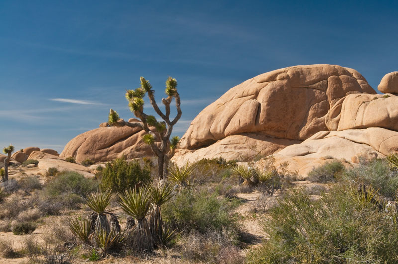
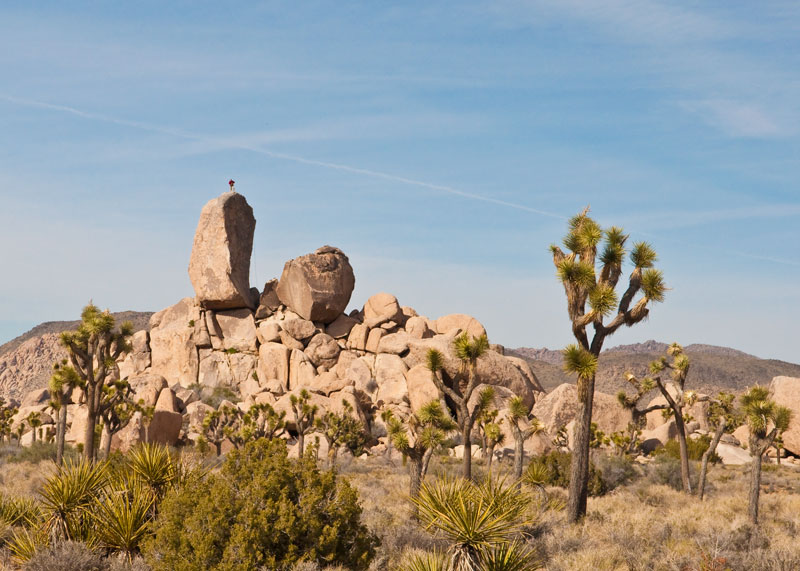
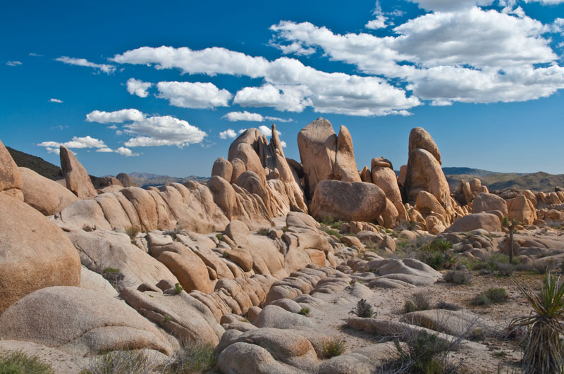
This Joshua Tree stands in front of a monzogranite outcropping that is also synonymous with the park.
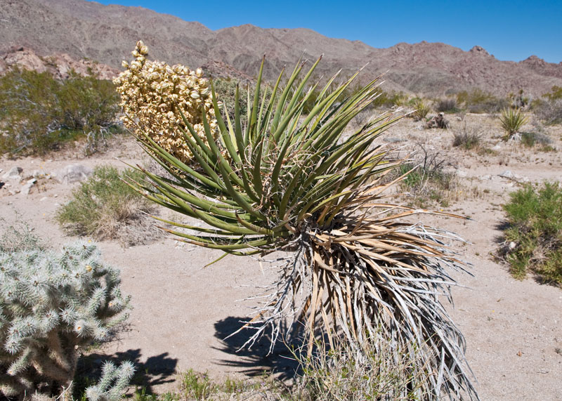
The Mojave yucca (yucca schidigera) is related to the Joshua Tree. The blossoms on this one are unfortunately beginning to fade but are similar to the blossoms of the Joshua Tree.
More Cholla: On the left is Pencil Cholla (opuntia arbuscula), characterized by its long thin stems, and to the right is Silver Cholla (opuntia echinocarpa), that has longer spikes and is less fuzzy in appearance than the Teady Bear Cholla. Note the burrow beneath the silver cholla plant. Some burrowing animal is cleverly using the cholla plant for protection.
Climbers were commonly seen practicing their skills on the monzogranite outcroppings. We watched this fellow climb up and down this precarious looking rock several times during his workout.
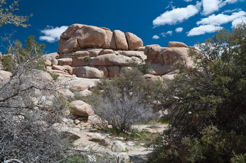
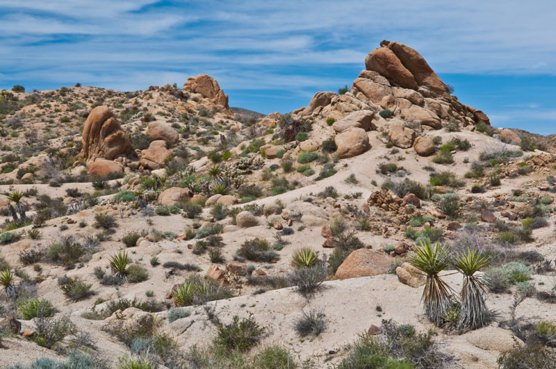
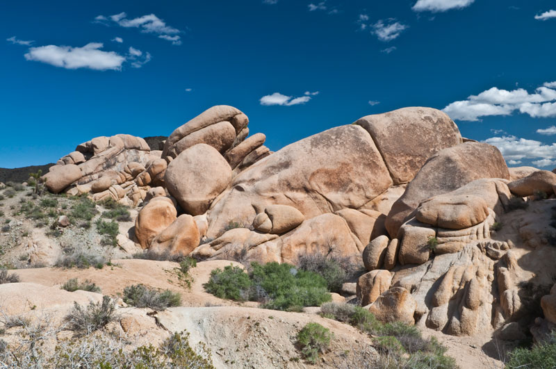
The monzogranite outcroppings exhibit characteristic horizontal and vertical joints (fractures) that resulted in rectangular blocks that weathered to the rounded shapes we see today.
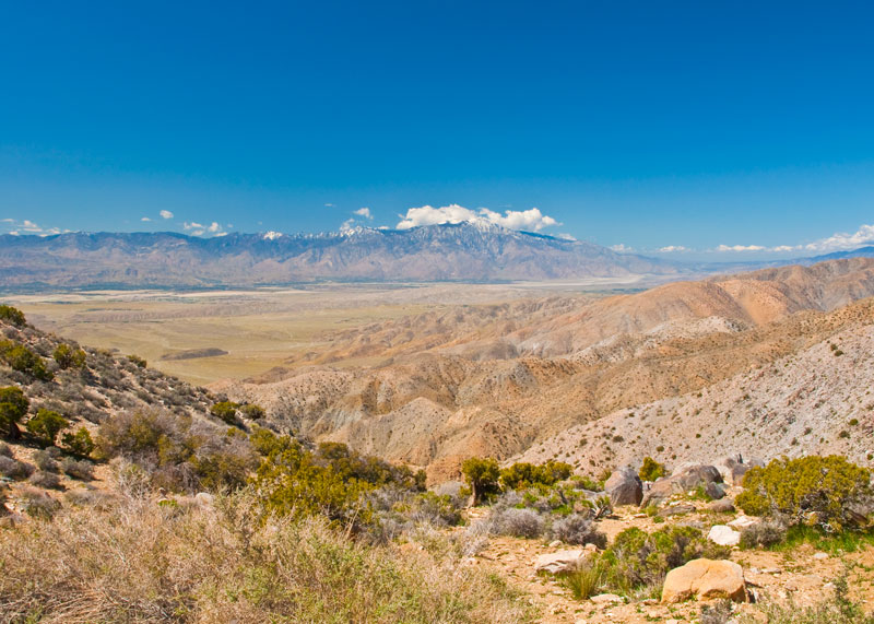
San Jacinto Peak (10,804 ft.), covered in snow, and the San Jacinto Mountains are seen from Keyes View in the Little San Bernardino Mountains that form the southwestern edge of the park. In the image below, we're looking southwest across the Coachella Valley towards Palm Springs. The low range of hills that run in a straight line east-west through the valley floor are called the Indio Hills; they mark the San Andreas fault.
San Gorgonio Mountain (11,499 ft.), looking west, as seen from Eureka Peak in the Little San Bernardino Mountains at the western edge of the park. Eureka Peak is accessible only by a 4 wheel drive vehicle. Thankfully, our friends Jim and Susan brought theirs. The view was spectacular and the sky clear. Unfortunately, the wind was gusting so hard I had to sit down behind a boulder to take this photo.
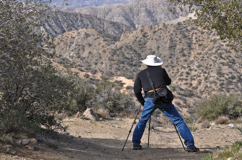
Denise captured me here bracing myself against the gusting wind to take a photo in what she calls my "quintuped" stance (that's 5-legged, so you don't have to look it up.) I should note that my hat was firmly strapped to my head both in front and in back, and I felt at times as if the wind would pull my head off.
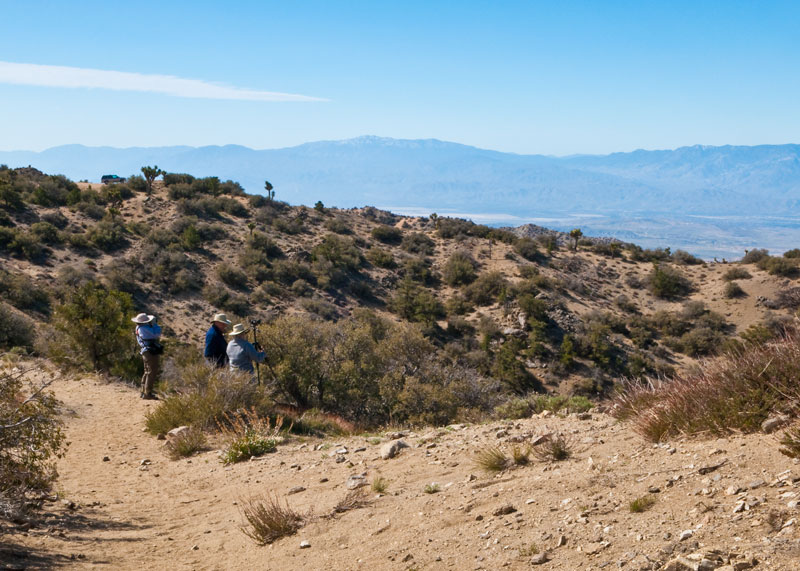
Denise, Jim and Susan discuss what next to do on Eureka Peak. In the distance to the south are the Coachella Valley, Palm Springs and Indio. Just out of view to the south is the Salton Sea. Our trusty 4-wheel drive steed awaits us in background.
![]()
![]()
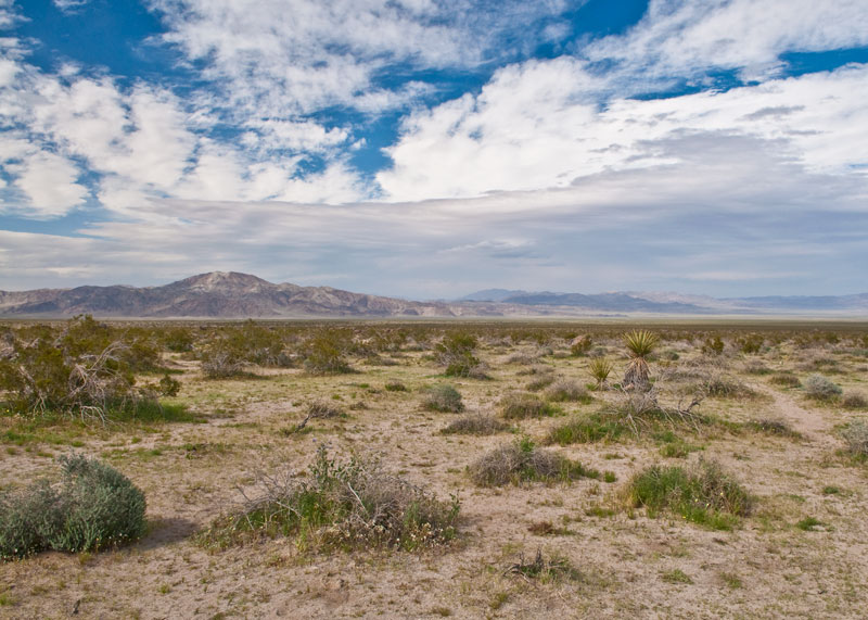
Here we're looking north-east over Pleasant Valley from the northern side of the Little San Bernardino Mountains on the Geology Tour Road. The Geology Tour Road is an 18-mile self-guilded drive through some of the park's most interesting geology. A 4-wheel drive vehicle is a must. We're standing at the southernmost extent of the loop road at the top of an alluvial fan. The road can be seen disappearing around the edge of the mountain on the right (part of the Hexie Mountains range), just left of center. The twin-peaked hill to left of center is called Malapai Hill. It is comprised of black basalt and rises about 400 ft. above the valley floor. Pleasant Valley and the mountains around it were formed by the Blue Cut Fault, one of the many faults that traverse the park.
Here is a wider-angle view from the same spot. Malapai Hill is in the middle. Queen Valley and the Queen Mountains are in the background.
Fortynine Palms Oasis (yes, 49 palms, and no, I didn't count them) is a moderately rugged 3 mile hike from the trailhead on the north side of the park. I took this picture from a ridge overlooking the oasis as the sun was setting behind the mountain to the right. Unfortunately, by the time we arrived at the oasis it was in shadow. Nevertheless, we had a great time bird watching while there.
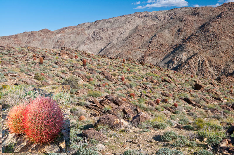
Barrel Cactus dot the landscape along the trail to the oasis. A more detailed view of the Barrel Cactus can be seen in the lower-left inset.
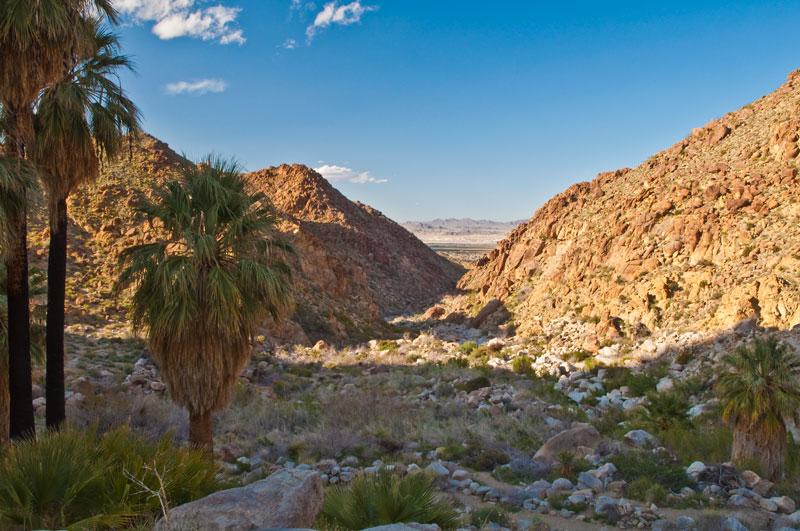
The Marine Corps Air Ground Combat Center at Twentynine Palms can just be seen to the north in the distance through the ravine from the Fortynine Palms Oasis. We heard the occasional detonation of ordnance in the distance as we hiked.
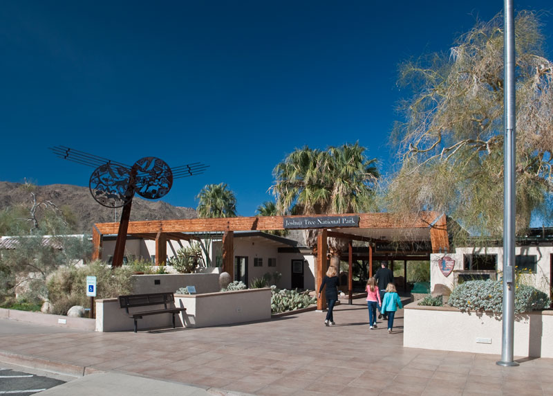
The Oasis Visitor Center at Twentynine Palms. We highly recommend you stop here to get your bearings. It is the largest and most interesting of the visitor centers.
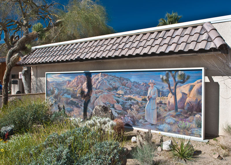
This mural, to the right of the visitor center entrance, is dedicated to Minerva Hamilton Holt who led the effort in the 1920's to preserve the desert by creating a federal park. Her efforts culminated in the establishment of 825,000 acres as a national monument in 1936 by President Roosevelt. In 1994, as a result of the California Desert Protection Act, Joshua Tree (along with Death Valley National Monument) was upgraded from national monument to national park status.
The Oasis of Mara is located behind the visitor center and is accessible via a short nature walk.
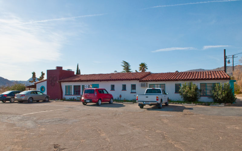
Our home away from home in Joshua Tree, the Joshua Tree Inn (http://www.joshuatreeinn.com/). Personally, I can't recommend this place. It's a dump, to be honest. It seems to have once been nice, perhaps ~1950, but then to have begun its current state of active decay. But our room was clean and quite, though there was no daily cleaning service, and I had to ask for more soap and TP on one occasion. Also, be forewarned that they no longer serve breakfast though they call themselves a bed and breakfast. Trust me when I say there are much better values along Twentynine Palms Highway. If you're coming for the wildflowers in spring, but sure and book your room early so you don't have to stay here.
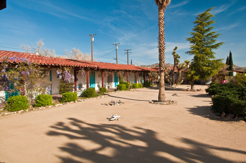
The view from our room across the Zen garden.
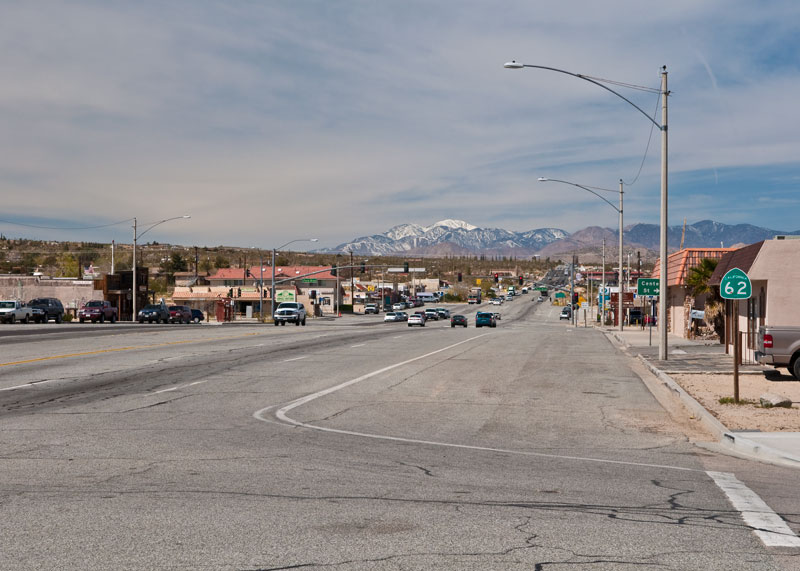
San Gorgonio Mountain can be seen in the distance in this view of Twentynine Palms Highway looking west from Joshua Tree.
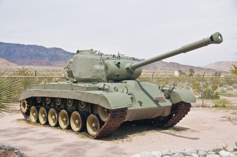
For something totally different, on the third day of our stay at Joshua Tree we drove to Chiriaco Summit to visit the General George S. Patton Junior Memorial Museum. Click on the image above for a link to the pictures of our visit to the museum. For the record, the tank above is an M26 Pershing, first introduced into combat in the last months of WWII and that saw considerable service in the Korean war.
We then drove to Lone Pine in the Owens Valley. Click on the picture above for a link to the latter part of our adventure.
![]()
![]()