
Death Valley - December 2006/January 2007
After picking up our friends, Jim and Susan, at their home in Southern California, we drove to Death Valley National Park for five days of exploration and photography. Here is the National Park Service Map: http://www.nps.gov/deva/planyourvisit/upload/DEVAmap1a.pdf. It's too large for me to display on this page in its entirety so that one can see its details, so you may wish to keep this map open to orient yourself while looking at the following pictures. I also include below more detailed maps to illustrate the places we visited.
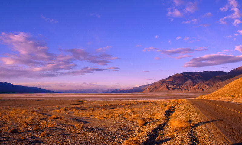
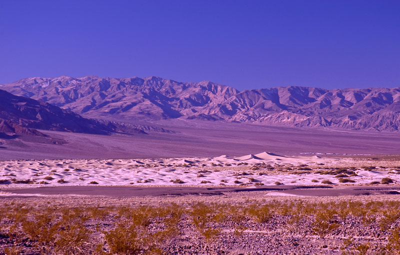
We entered Death Valley National Park near dusk from the south-east on Highway 178. After crossing Jubilee Pass, Highway 178 swung north and we got our first look into Death Valley. Here we're looking roughly north over Badwater Basin that, at 282 feet below sea level, is the lowest point in the North America, from the side of Highway 178. The Amargosa Range is to the right, the Panamint Range is to the left, and Furnace Creek, where we will stay, is just below the Funeral Mountains in the far distance.
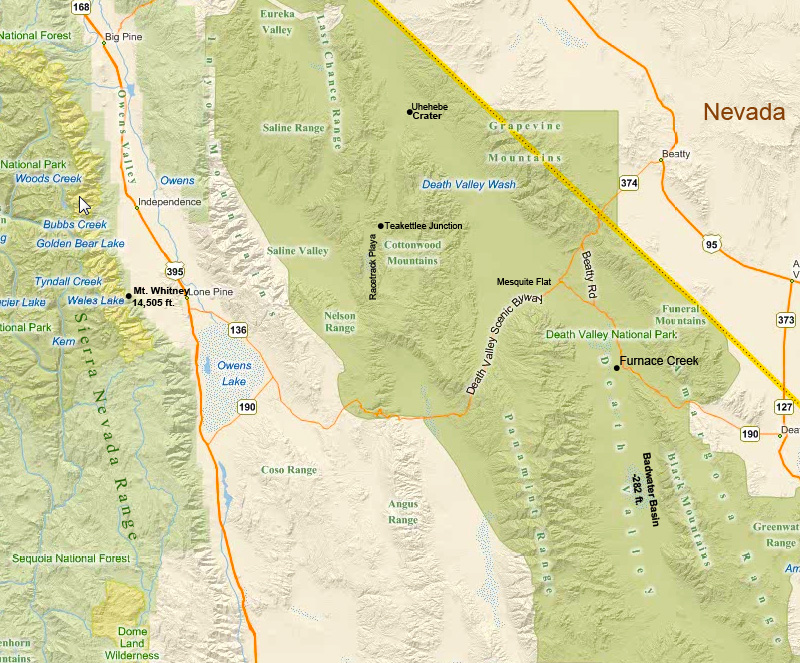
Death Valley National Park, below, shaded in green, sits in the Mojave Desert in south-eastern California and western Nevada. Badwater Basin in Death Valley is the lowest point in North America at 282 ft below sea level, and it is one of the driest since it sits in the rain shadow of several mountain ranges to the west. About 75 miles to the west of Badwater Basin is the highest point in the Continguous 48 States, Mt. Whitney in the Sierra Nevada Mountains, at 14,505 ft above sea level.
Geologically, Death Valley is a graben, i.e. a drepressed block of land, between the two vertical fault scarps that formed the mountain ranges on either side, similar to the Owens Valley to the northwest; see our Owens Valley travelogue: Owens Valley. Both Death Valley and Owens Valley are within the Eastern California Shear Zone characterized by parallel strike-slip faults that formed the parallel and alternating mountain ranges and valleys that run roughly north-south. Death Valley is framed by the Amargosa Range to the east and the Panamint Range to the west. Further to the west, and running roughly parallel to these ranges, are the Inyo and the Sierra Nevada Ranges. (Map above by Bing; additional place names added by me)
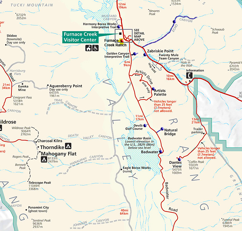
Here is a detail from the National Park Service map showing the south-eastern part of Death Valley. Blue dots mark the places we visited. We stayed at the Furnace Creek Ranch (http://www.furnacecreekresort.com/), marked by a red dot, located roughly in the center of the park just north of the intersection of Highways 190 (entering from the east) and 178 (Badwater Road from the south).
Zabriskie Point: On our first morning in Death Valley we drove to Zabriskie Point located just south of Highway 190 in the Amargosa Range that roughly defines the eastern edge of the park. Zabriskie Point got its name from Christian Zabriskie, vice-president and general manager of the Pacific Coast Borax Company that mined Borax at the Harmony Borax Works near Furnace Creek during the 19th and 20th centuries. Zabriskie Point is a must see destination known for the beautifully eroded multi-color sedimentary rock that was deposited there millions of years ago when the area was covered by an inland sea.
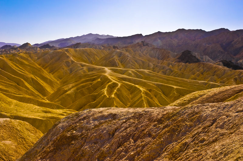
Zabriskie Point seen ,as the sun rises over the Funeral Mountains to the east.
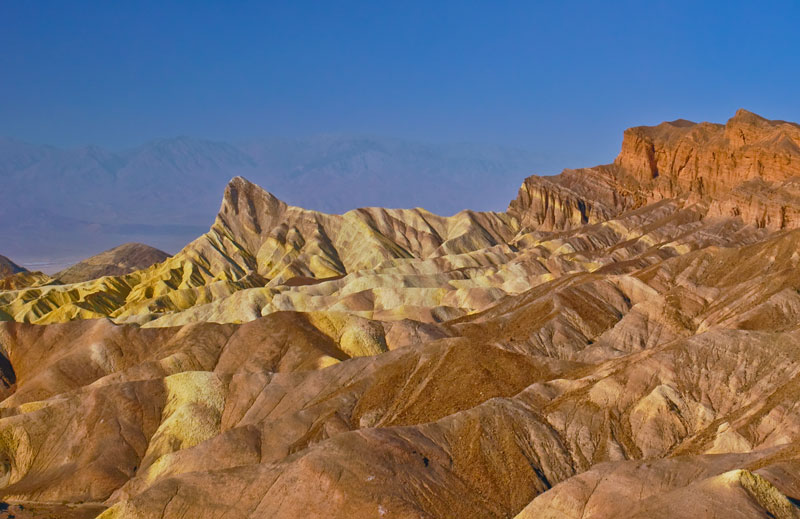
Another view of Zabriskie Point at dawn looking at the distant Panamint Mountains through the morning haze.
![]()
![]()
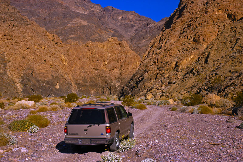
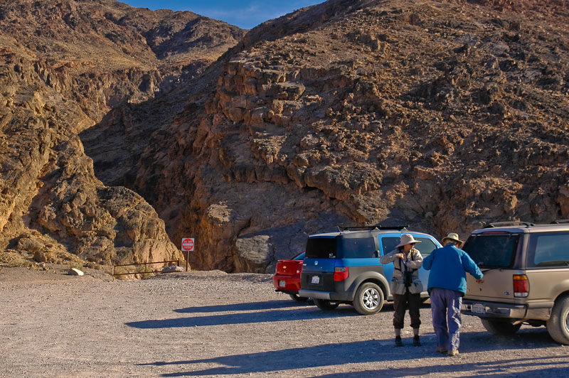
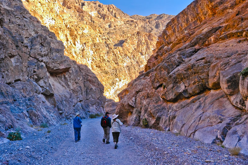
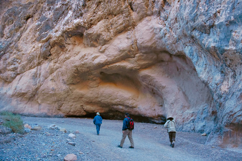
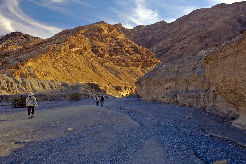
Echo Canyon: Later that morning, we drove to Echo Canyon, located not far from Zabriskie Point just off Highway 190, in the Funeral Mountains of the Armagosa Range. Here our our friends' 4-wheel drive vehicle enters the canyon. Though 4-wheel drive was not a requirement for most of the places we visited, it definitely conferred greater confidence.
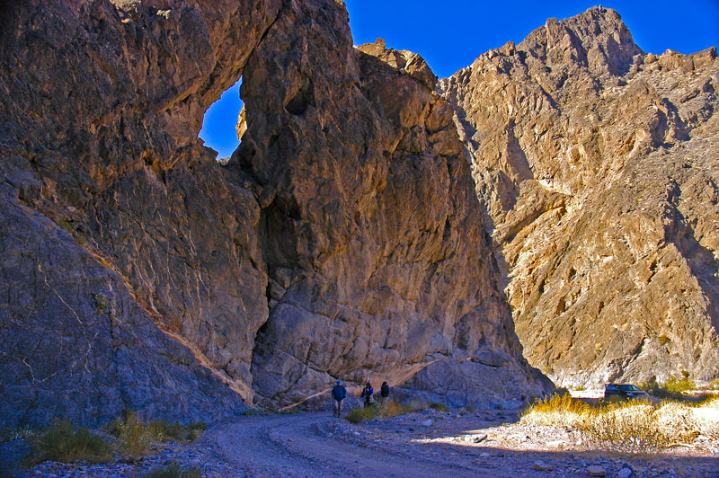
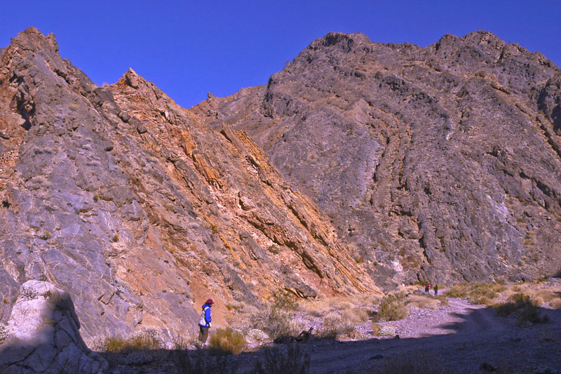
Echo Canyon, with it steep twisted sides, is a dramatic example of a canyon formed by movement of a thrust fault followed by erosion as seen in the photos above and below.

Denise takes her time to examine and photograph a barrel cactus.
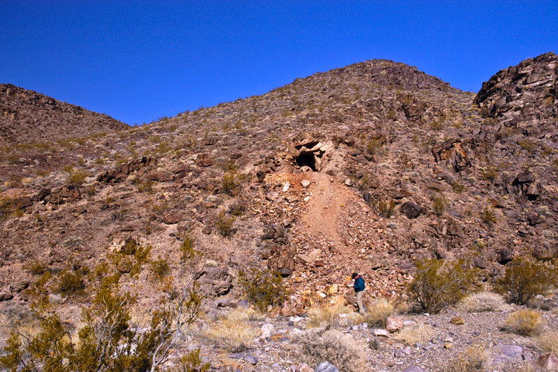
Further back in Echo Canyon we found evidence of past mining activity. Here Jim inspects talus from a mine.
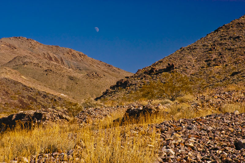
As we had lunch we watched the moon rise over the back of Echo Canyon.
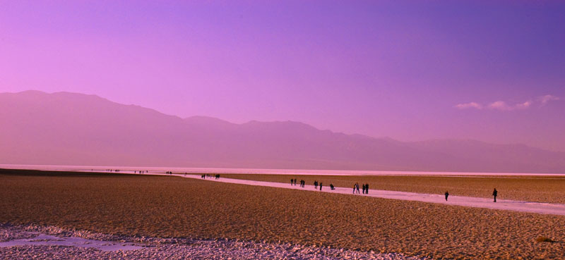
Badwater: In the afternoon we headed for Badwater Basin. As mentioned above, this is the lowest elevation in North America at 282 ft below sea level. At Badwater Basin you can walk out onto the salt flats, though you're encouraged to do so with caution since in places only a thin salt crust covers deep mud. During especially rainy years, a sizeble lake can form, e.g. Dec. 2005 - only the year before this trip. The Panamint Range is in the background.
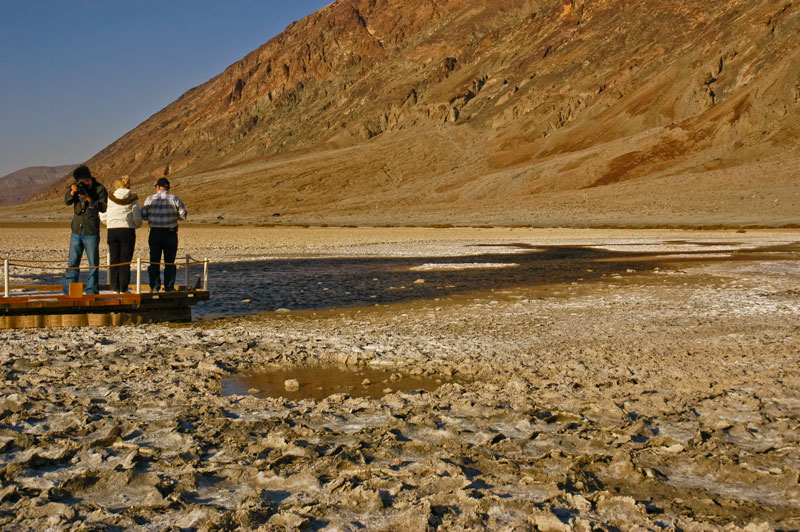
Near the road, Highway 178, water percolates to the surface as a spring.
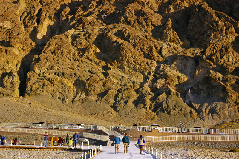
Here Susan, Jim and Denise, walk back to the parking lot at Badwater Basin. Note the Sea Level sign near the top of the image just left of center.
![]()
![]()
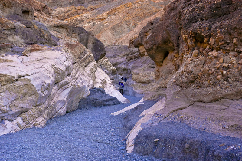
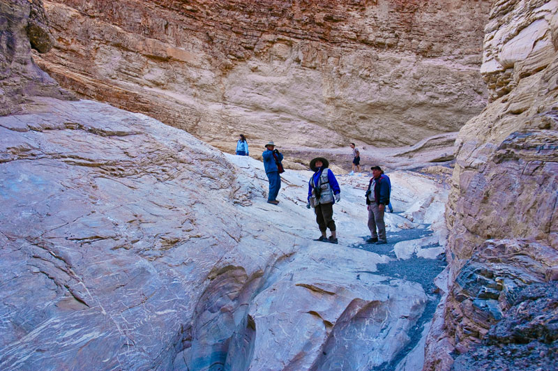
Natural Bridge Canyon: Late in the afternoon, we drove to Natural Bridge Canyon. About 0.3 miles into the canyon we came upon the eponymous natural bridge.
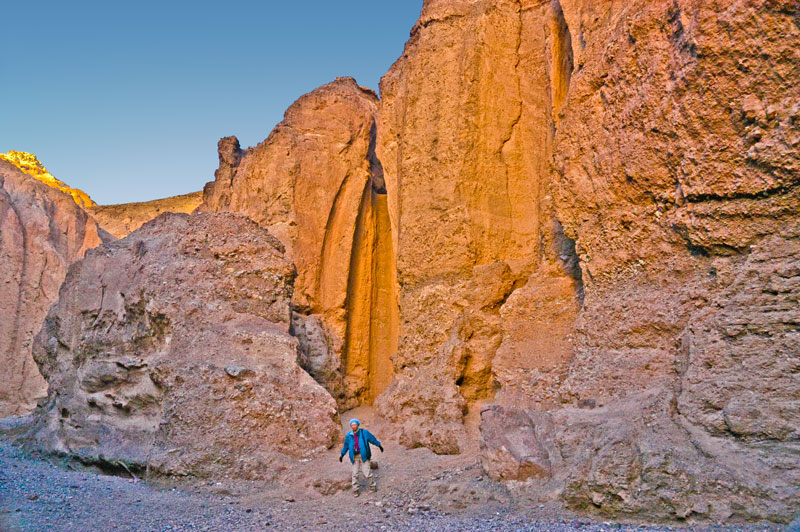
About a mile into the canyon we came upon several dramatic dry waterfalls. Susan kindly climbed to the base of this one below to supply scale.
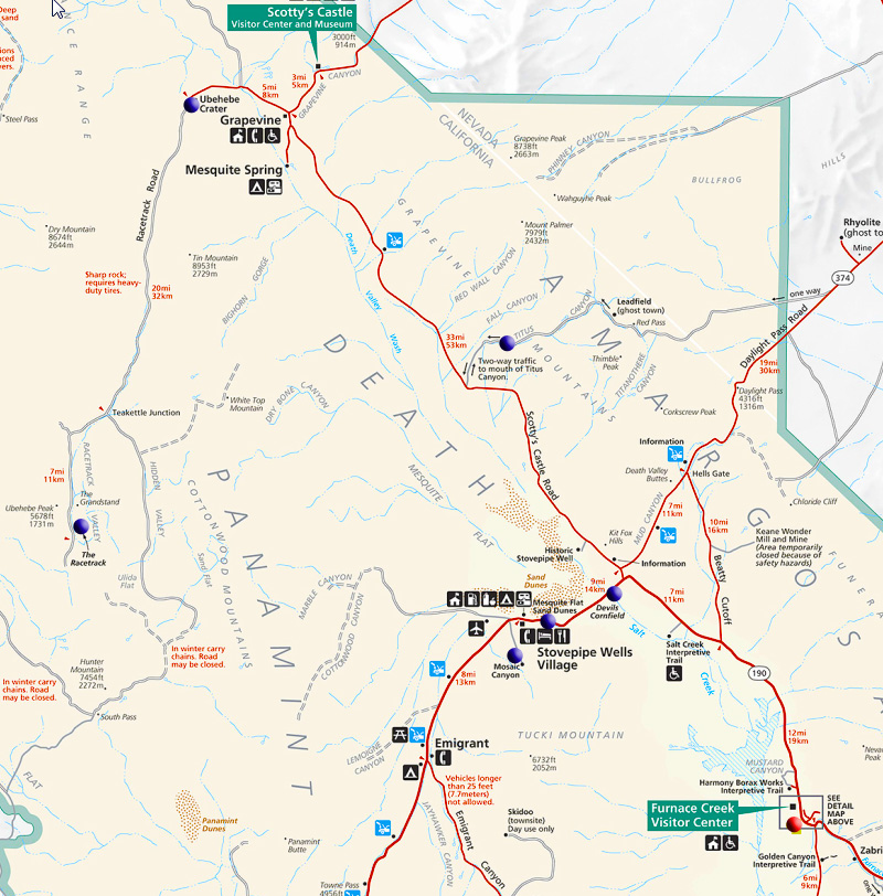
Here is a detail from the National Park Service map showing the north-eastern part of Death Valley. The places we visited are marked by blue dots. On our second day we drove to the Racetrack (left-center in map above) via Ubehebe Crater and Teakettle Junction along Scotty's Castle Road (paved) and the Racetrack Road (gravel and dirt).
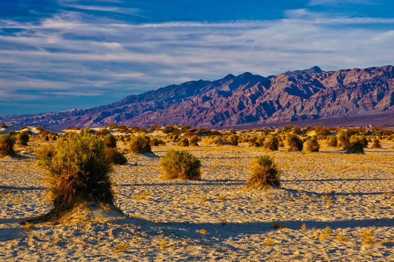
As we drove north along Scotty's Castle Road in the morning, we passed the Mesquite Flat Sand Dunes to the west, below, that we would return to that evening. Note the large alluvial fan spreading out from the Panamint Mountains behind the dunes.
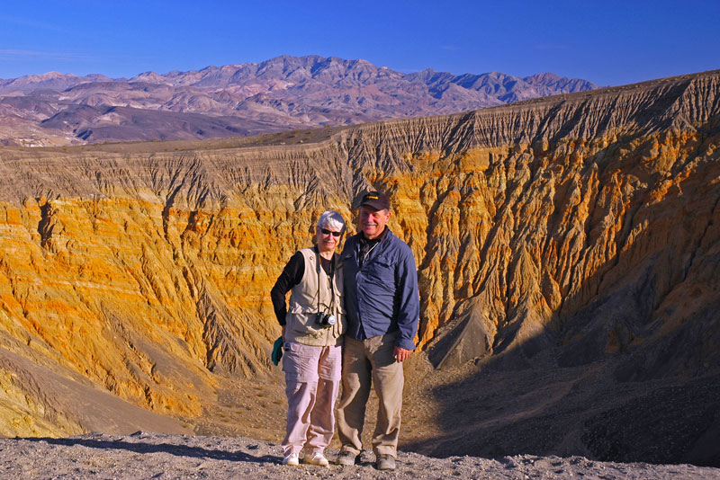
Ubehebe Crater: After passing the fork to Scotty's Castle, the road swung south and passed the Ubehebe Crater, where we stopped to stretch our legs and explore. The Ubehebe Crater is a fairly sizeable volcanic crater created when groundwater flashed into steam after coming in contact with hot magma causing a violent explosion. The Ubehebe Crater is actually the largest, and youngest, of several overlapping craters. It measures about half a mile wide by about 700 feet deep. Here Jim and Susan pose in front of it.
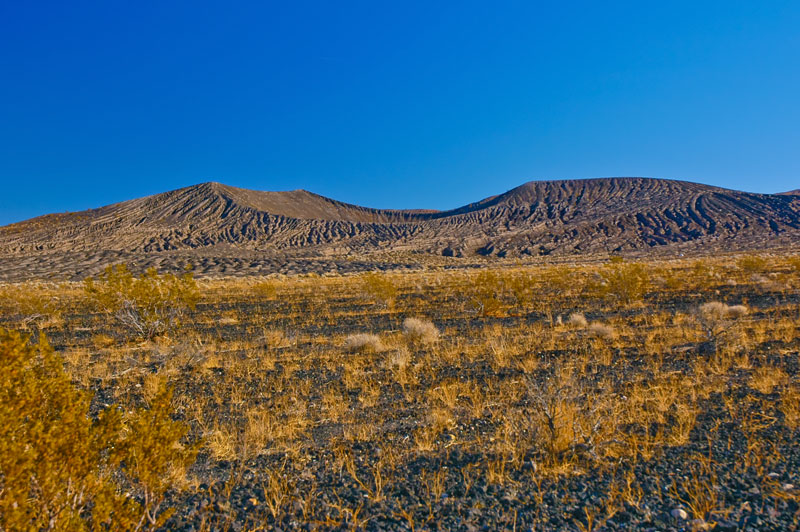
Here is another volcanic crater near Ubehebe, this one is unnamed as far as I know.
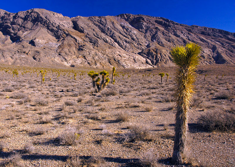
After passing Ubehebe crater, the road changed from paved to gravel and dirt; we were then on the Racetrack Valley Road. We climbed in altitude to over 4900 feet and passed through a forest of Joshua Trees. It steadily became colder, and in places there were patches of snow on the ground.
![]()
![]()
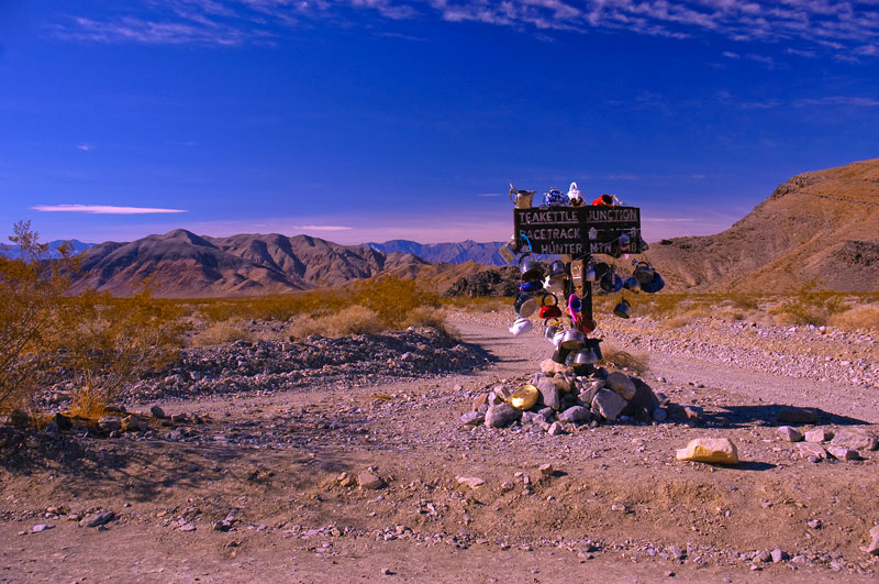
Teakettle Junction: The Racetrack Valley Road forks at Teakettle Junction which is well marked by a sign festooned with teakettles left by past visitors. Ubehebe Peak rises in the left background.
The Racetrack: The Racetrack or Racetrack Playa is a seasonally dry lakebed. Rainfall covers the playa with a thin layer of water which quickly evaporates leaving a slick mud that cracks into polygonal shapes as it dries. When dry, the playa is very hard and walking on it leaves no discernable marks. The Racetrack is famous for its "sailing rocks" that apparently move, with no intervention from human or animal, leaving their tracks behind. No person has ever seen the stones move.
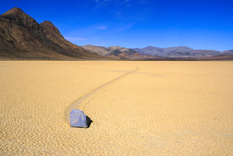
In this photo, looking roughly north from the south end of the playa, is a sailing rock and its track. The Last Chance Range rises to the left, and the Grandstand can just be seen at the far end of the playa right of center.
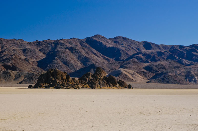
Towards the north end of the Racetrack, rises the Grandstand, a quartz monzonite outcropping (volcanic) that stands about 70 feet high. It is the only relief in the otherwise nearly flat playa. The Racetrack Playa measures about 2.8 miles long (north-south) by 1.3 miles wide (east-west), and its surface drops by only about 1.5 inches from north to south.
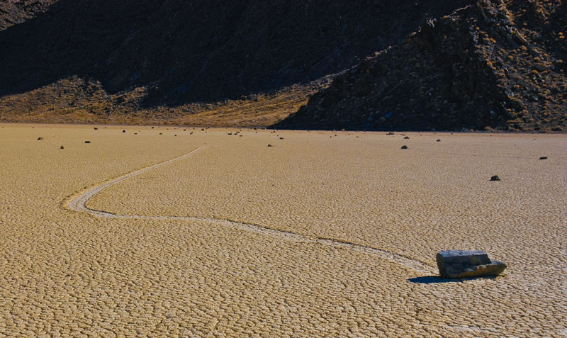
Most of the moving stones can be found in the south-east corner of the playa where they appear to originate in the talus of the Cottonwood Mountains that line the playa's west side (in the background of the image below). Scientists studying the sailing stones, by GPS transmitters attached to the stones, believe they are moved by the wind, which can gust to 90 miiles/hr during winter storms, when the playa is wet and its surface is very slippery.
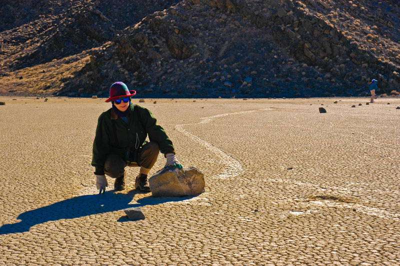
Denise kneels by one of the sailing rocks. These rocks can be quite heavy. This particular stone probably weighs well over 100 pounds, and its meandering track can be seen behind it. Some of the sailing rocks weigh more than 300 pounds.
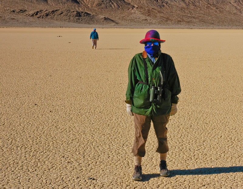
Dressing for exploration of the Racetrack in winter: dress warmly. I don't know what the temperature was, close to freezing judging from the snow on the ground in protected places, but it was bitterly cold and the wind was gusting. Denise is dressed here in her cold weather adventure clothing. I didn't have gloves and had to keep my hands in my pockets between pictures. Susan, seen walking away in the background, is similarly (and intelligently) dressed warmly.
![]()
![]()
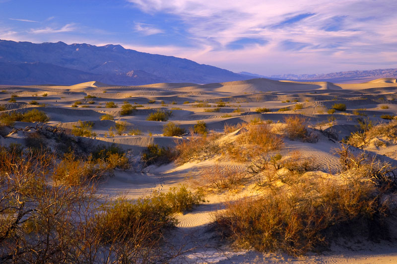
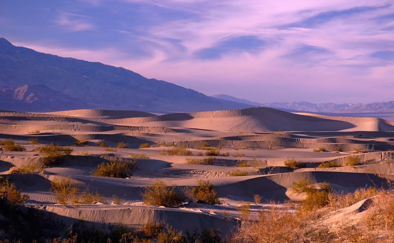
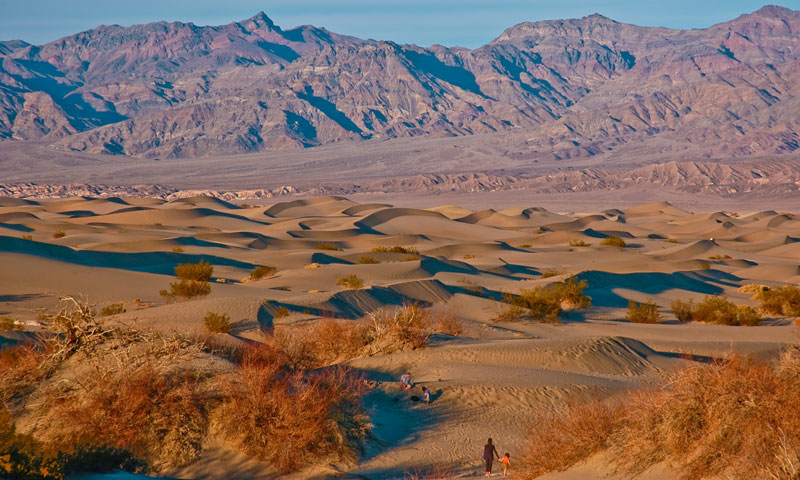
Mesquite Flat Sand Dunes: On our drive back to Furnace Creek we took time to stop and admire the Mesquite Flat Sand Dunes near Stovepipe Wells at sunset. This photo was taken from the side of Highway 190 near Stovepipe Wells. The Cottonwood Mountains of the Panamint Range lay in the background.
People could be seen walking about looking for a good vantage on top of a dune to view the sunset.
Here's another vantage of the Mesquite Flat Dunes with the Grapevine Mountains supplying the backdrop.
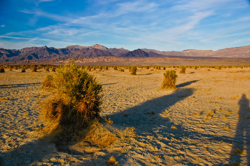
The Devil's Cornfield: The Devil's Cornfield at dusk, located on the other side of Highway 190 from the Mesquite Flat Dunes. The Grapevine Mountains are in the distance.
![]()
![]()
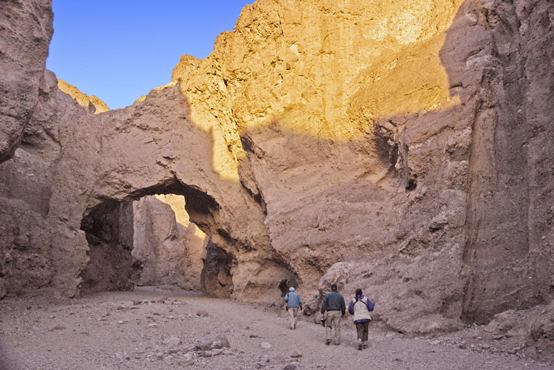
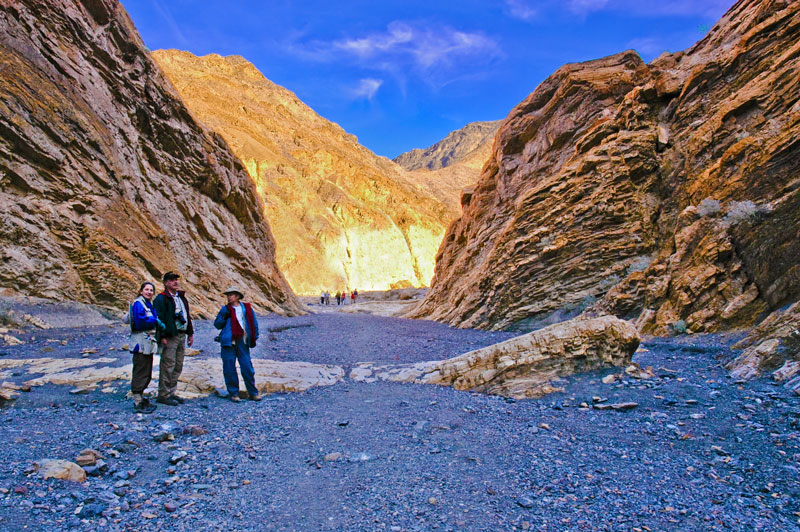
Titus Canyon: We began our next day by exploring the western side of Titus Canyon, located about 30 miles north of Furnace Creek along the Scotty's Castle Road. The canyon entrance from the west (below) is inauspicious, very narrow, and is arrived at after a 3-mile drive over a dirt road from the Scotty's Castle Road. The Titus Canyon Road continues all the way through the Grapevine Mountains of the Amargosa Range to Nevada, about 27 miles, but is one-way traffic only from east to west, so from the west your only choice is to walk.
Denise and our friends walk through the Titus Canyon narrows. In places the canyon walls are separated by only 20 feet.
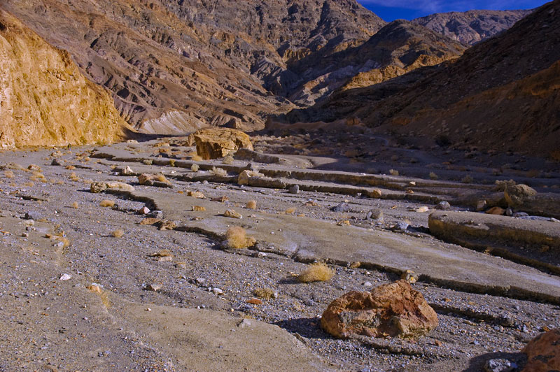
During storms, the fast-moving water runoff is channeled through the narrows, creating obvious erosion patterns in the canyon walls.
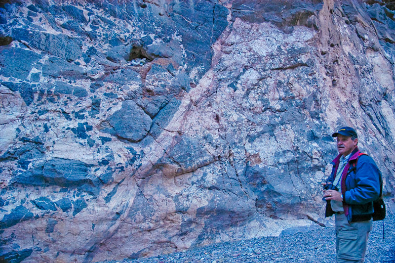
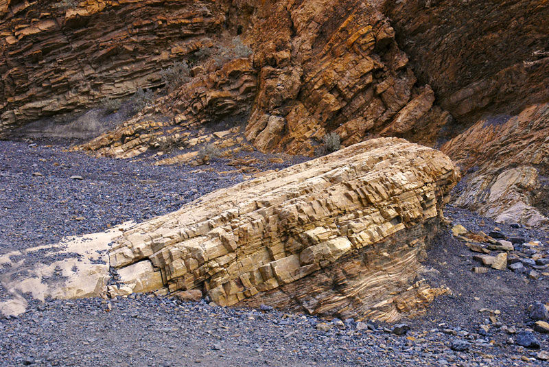
Numerous interesting and beautiful limestone breccia are found in the canyon walls. Below, Jim, a professional geologist, prepares to do some photography.
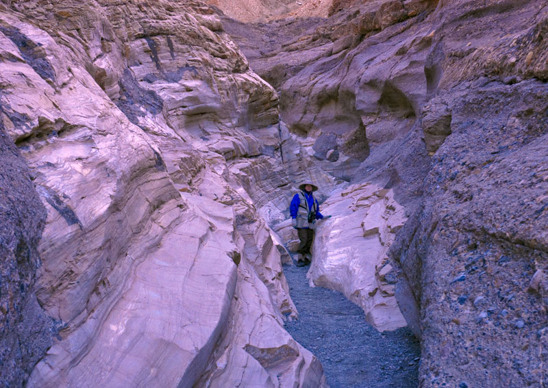
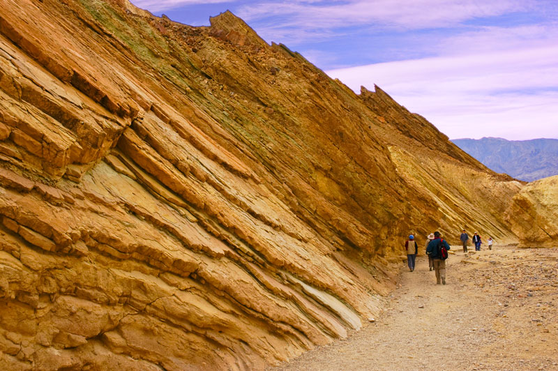
Mosaic Canyon: In the afternoon, we set off to explore Mosaic Canyon which is located off Highway 190 just west of Stovepipe Wells in the side of Tucki Mountain. Denise and our friends enter Mosaic Canyon over a broad alluvial fan in the photo below.
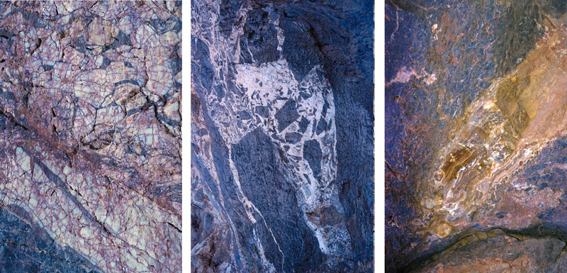
Mosaic Canyon quickly narrows, and in places one can touch both sides with outstretch arms. The canyon gets its name from the mosaic brecchia of dolomite in a pebbly matrix that can be seen to the extreme right in the photo below. Note the exposed weathered marble that geologists call Noonday Dolomite to the left.
Mosaic Breccia.
Here we had to squeeze between walls of sinuously polished marble...
...and then we had to scramble over marble steps.
Finally, the canyon widened.
Here tilted layers of dolomite are exposed by uplift and erosion.
The back of Mosaic Canyon.
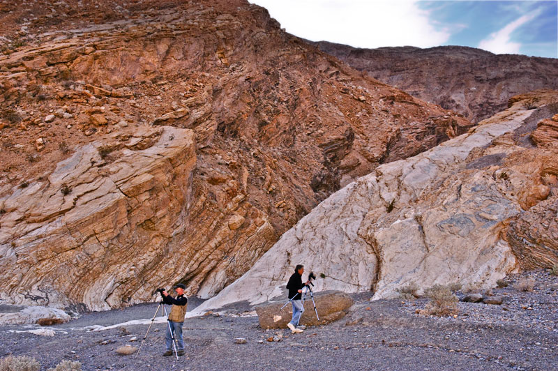
Mosaic Canyon is a popular spot for photography. Here, I caught two photographers at work.
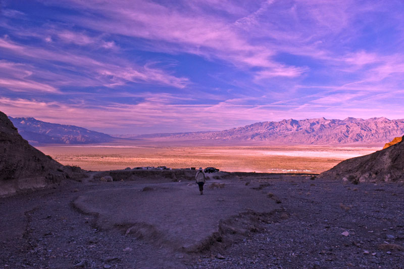
After retracing our steps, we emerged into the light from Mosaic Canyon. Mesquite Flats lays in the distance framed by the Grapevine Mountains to the right and the Cottonwood Mountains to the left.
![]()
![]()
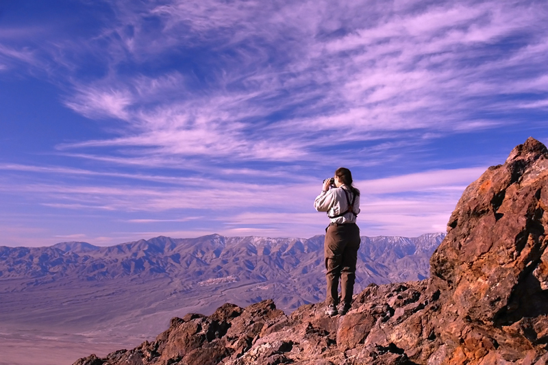
Dante's View: Dante's View is another must-see since it affords spectacular views of Death Valley from 5,475 ft near the top of the Amargosa Range looking south, north, and west toward the Panamints. Dante's View is reached by driving about 10 miles south-east from Furnance Creek on Highway 190, then driving another 10 miles along the Greenwater Valley Road. Below, Denise looks southwest towards the Panamints.
Telescope Peak (11,049 ft), the highest point in in the distant Panamint Range, and the highest point in Death Valley National Park, is seen looking west across Death Valley.
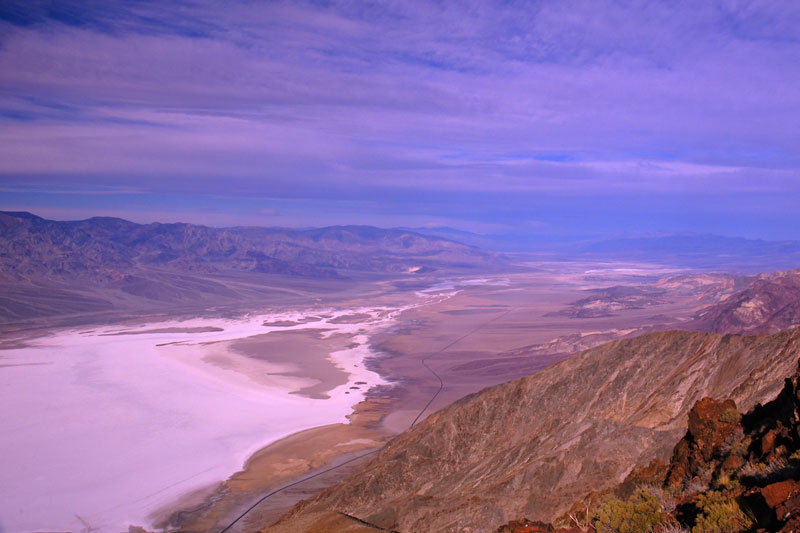
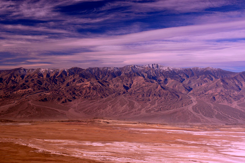
Death Valley looking north-west from Dante's View towards Stovepipe Wells. Badwater Basin glares whitely at the lower-left, and the slightly darker stain where people have walked out upon the salt can be seen at the extreme bottom-left. The Badwater Road can be seen disappearing into the distance to the north.
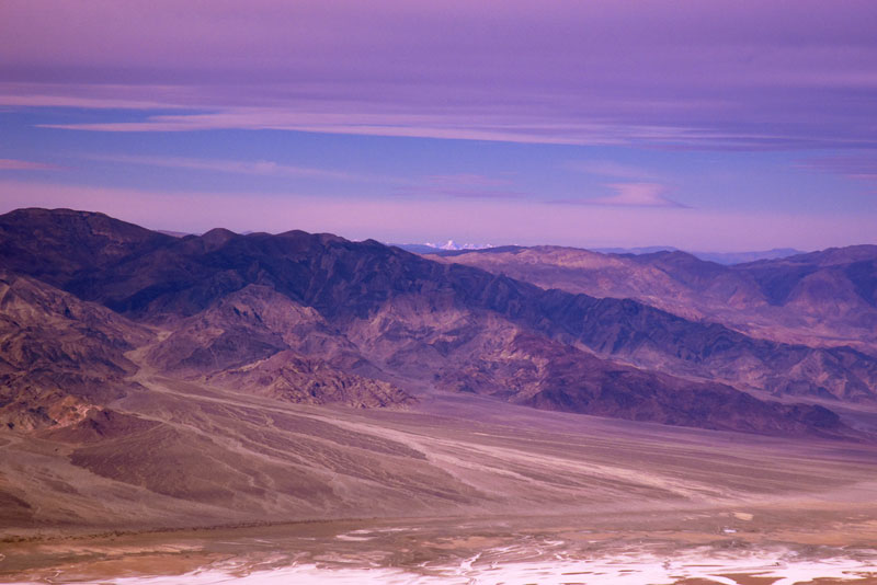
Snow-covered Mount Whitney and its surrounding peaks in the Sierra Nevada are just visible beyond the Panamints and the intervening Inyo Range looking to the northwest, about 80 miles away from this vantage. Thus, on a clear day, from Dante's View one can see the highest and lowest points in the Contiguous 48 States.
>
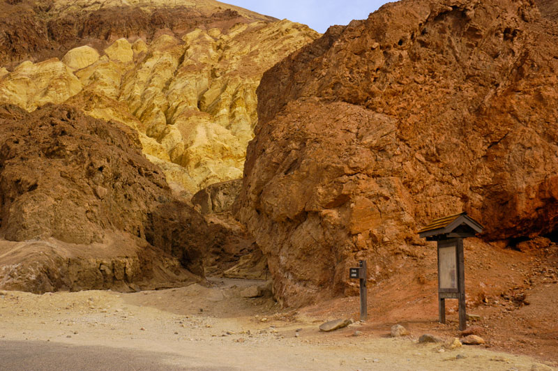
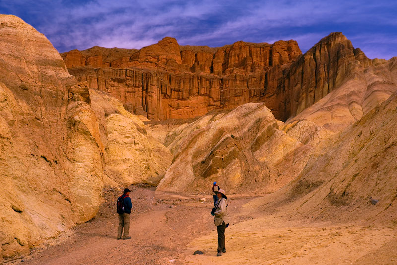
Golden Canyon: Golden Canyon is located about 2.5 miles south of Furnance Creek on the Badwater Road, and is just opposite Zabriskie Point in the Amargosa Range. In fact, one can hike to Zabriskie Point from here, about 4 miles round trip. The entrance to Golden Canyon is shown below. Like Zabriskie Point, the spectacular yellow, orange, red, and pink sedimentary rock is the major attraction, and the source of the canyon's name.
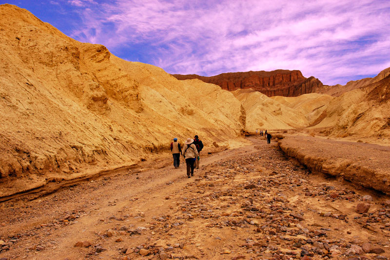
The Golden Canyon interpretive hike is easy and about 1 mile roundtrip.
The Red Cathedral rises majestically at the end of the Golden Canyon interpretive trail, about 0.5 miles from the canyon entrance. The Red Cathedral is composed of a red iron oxide rich rock that is harder, and slower to erode, than the stone around it.
As we leave Golden Canyon we walk past uplifted layers of sedimentary rock. The Panamints can be seen in the distance.
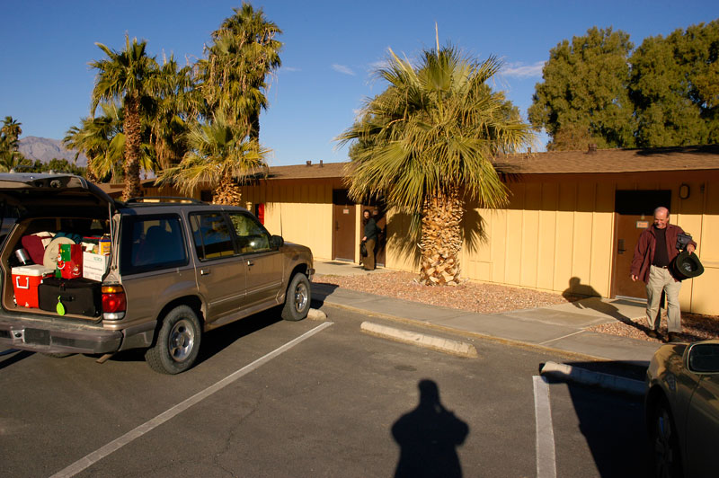
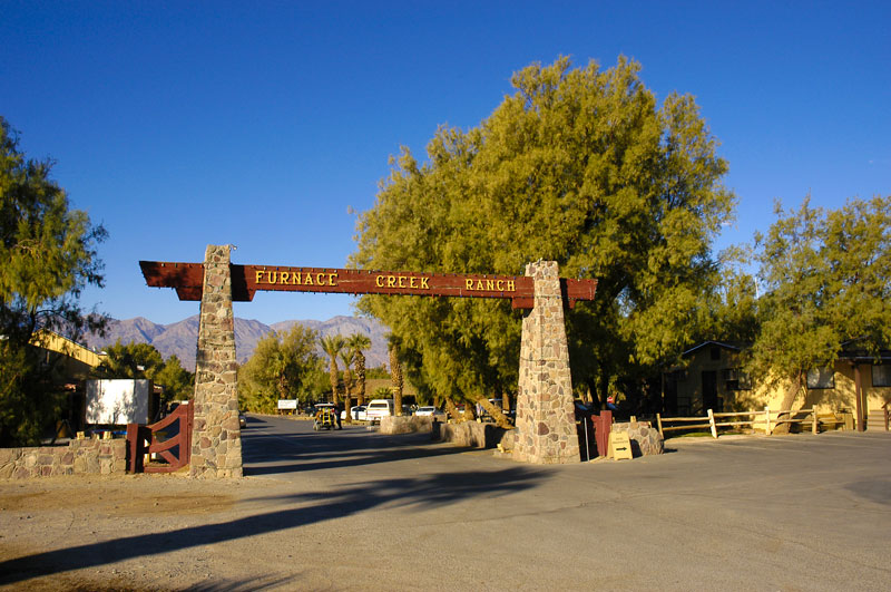
Our home while on this adventure was the Furnace Creek Ranch http://www.furnacecreekresort.com/. The accommodations were simple, as you can see, but fine. Be sure to make your reservations well in advance since there are limited rooms at the ranch and the nearby resort. There are also campgrounds at Furnace Creek and at Stovepipe Well. Here, on New Year's Day 2007, we are packing for our drive home.
![]()
![]()