
Owens Valley - April 2010
We entered the Owens Valley from the south on Interstate 395 after driving north from our 4-day visit to Joshua Tree National Park.
Arguably, this was an extension of our Eastern Sierra Nevada trip of last October in which we got only as far south as Big Pine, at the northern end of Owens Valley, on our way to the Ancient Bristle Cone Pine Forest in the White Mountains. As always, we were limited in time and had to get back to work. Don't we all wish we had all the time in the world to travel? (Map below from Google with some place names added by me.)
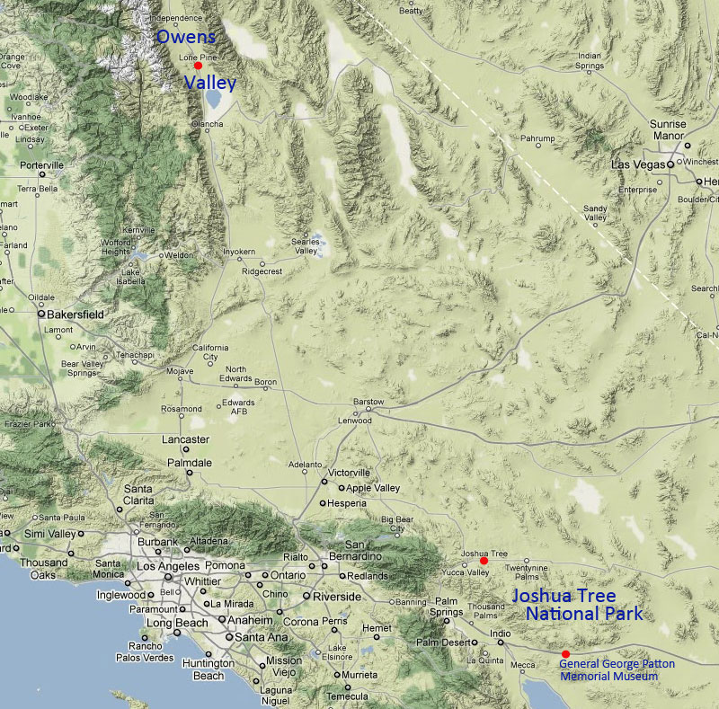
Map of Southern California from Owens Valley to Joshua Tree National Park, the range of this trip. (Map from Google.)
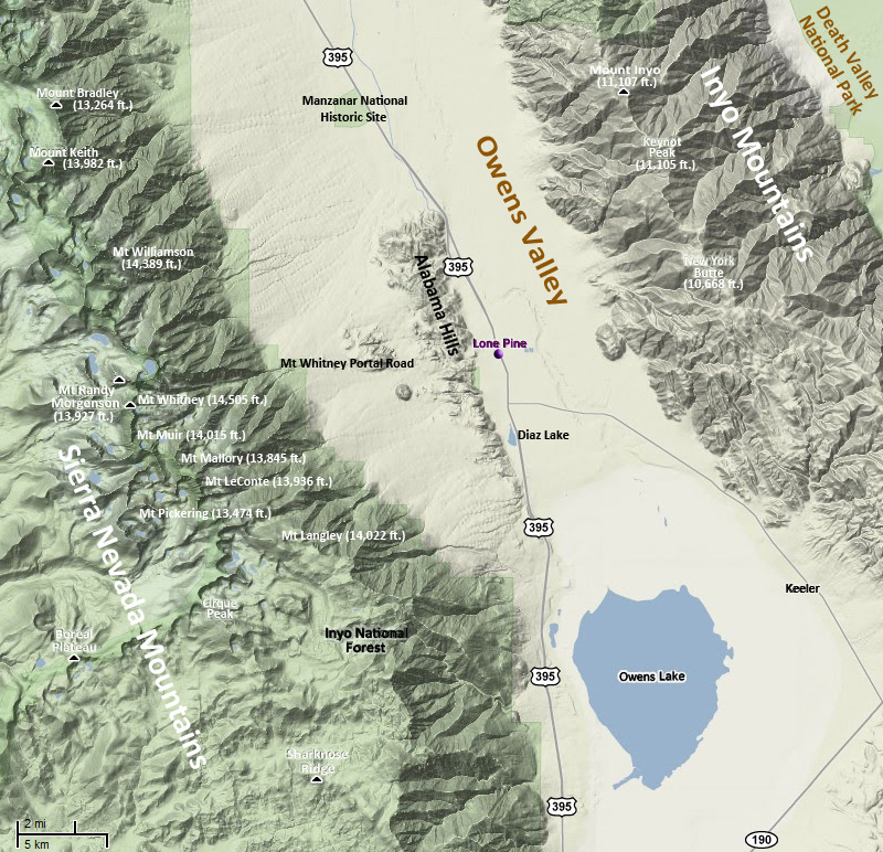
A more detailed map of Owens Valley around Lone Pine is shown above. The Owens Valley is in the rain shadow of the Sierra Nevada to its west and is therefore quite arid. Around Owens Lake, at the southern end of the valley, it is mostly an alkaline plain that is prone to alkiline dust storms. (More below on that.) The Owens Valley is bounded by the Sierra Nevada to the west, the Inyo Mountains to the east and the White Mountains to the northeast (not shown in this map). Geologically, Owens Valley is a graben, i.e. a drepressed block of land, between the two vertical fault scarps that formed the mountain ranges on either side. The floor of the valley is at approximately 4,000 ft. Many peaks in the Sierra Nevada and the White Mountains tower above 14,000 ft. Mt. Whitney, at 14,505 ft. (I believe this is the current measurement), is the highest peak in the 48 contiguous states. The Inyo Mountains are somewhat shorter but still quite impressive. For example, Keynot Peak in the Inyo Mountains is 11,105 ft high. (Map from Google with several place names and other information added by me.)
The Alabama Hills are an interesting geographic feature in Owens valley. Though they appear to be a separate range, they are geologically part of the Sierra Nevada and are of the same age. They appear quite different from the Sierra Nevada Mountains, being considerably shorter for one thing, but also differing in their erosion pattern, being more rounded and less jagged than the Sierra escarpment immediately to the west. See the images below.
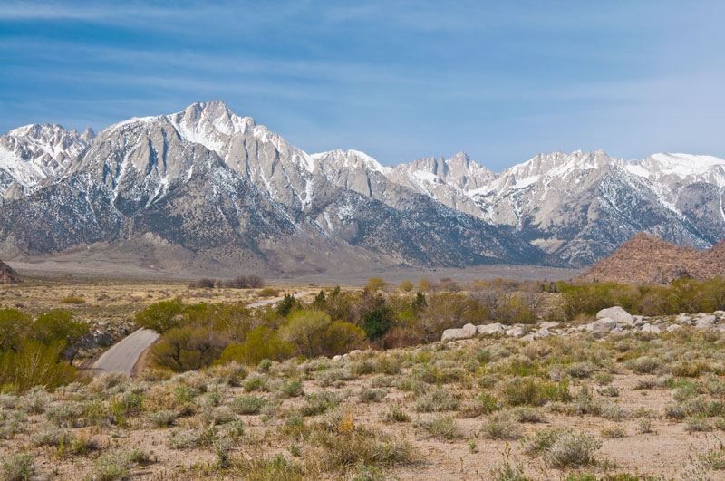
Mount Whitney is seen below from the intersection of the Whitney Portal and Movie Roads in the Alabama Hills. The Whitney Portal Road disappears into the distance on its way to the trailhead for hiking to the summit of Mt. Whitney from the east (http://www.fs.fed.us/r5/inyo/recreation/wild/mtwhitney.shtml). Mt. Whitney is right of center and appears somewhat lower in height than the peaks around it since it is more distant from the vantage of this photo. Mt. Randy Morgenson is to the right, and Mt. Muir to the left.
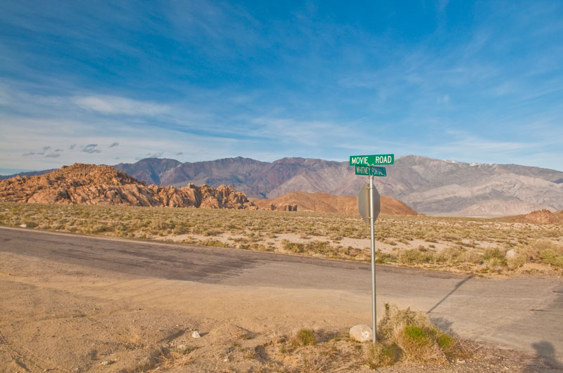
The intersection of Whitney Portal and Movie Roads in the Alabama Hills looking northeast. The Inyo Mountains can be seen in the background.
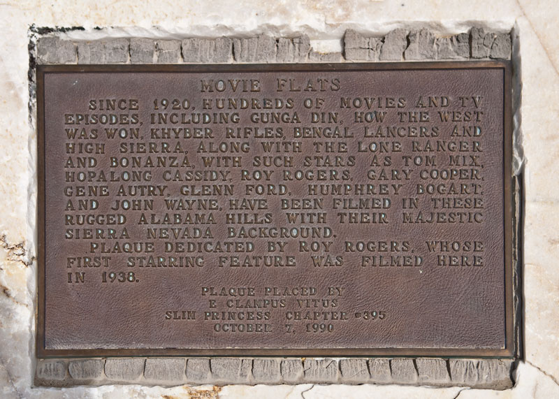
This plaque at the intersection of the Whitney Portal and Movie Roads commemorates the many movies and television programs filmed in the colorful Alabama Hills.
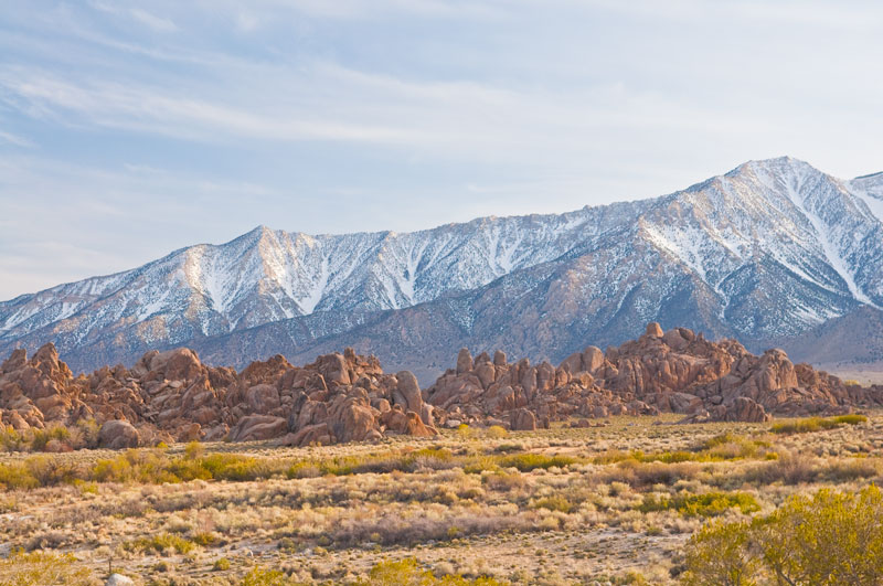
The Sierra Nevada rises above metamorphosed rock outcroppings of the Alabama Hills. It is this kind of scenary that attracted early Hollywood to shoot their westerns and other action films here. The Sierra Nevada even stood in for the Himilayas in such films as Gunga Din, a 1939 film made by RKO Pictures. This photo was taken from Movie Road.
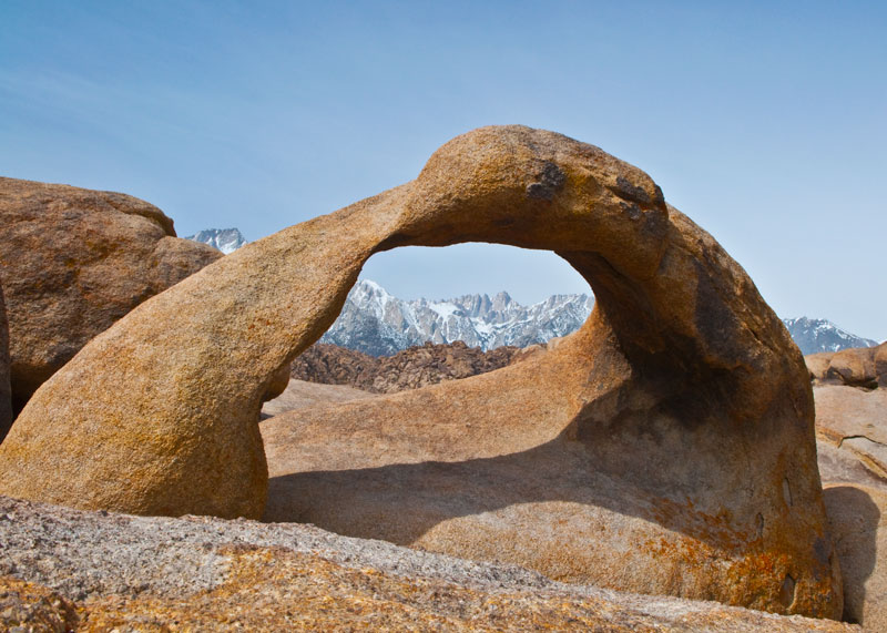
Mount Whitney is neatly framed through a rock arch in the Alabama Hills. This is a famous photo. To my surprise the arch was quite small and to take the photo I had to lie on my side on the very rough rock in the foreground (where I left some skin from both hands, by the way) with the camera mounted on a tripod only about a foot off the rock surface. This site is just off Movie Road.

Another view of the Alabama Hills looking east toward the Inyo Mountains in the background. The Alabama Hills were named after a Confederate warship by southern sympathizers during the American Civil War, and they are currently managed by the U.S. Bureau of Land Management as the Alabama Hills Recreation Area.
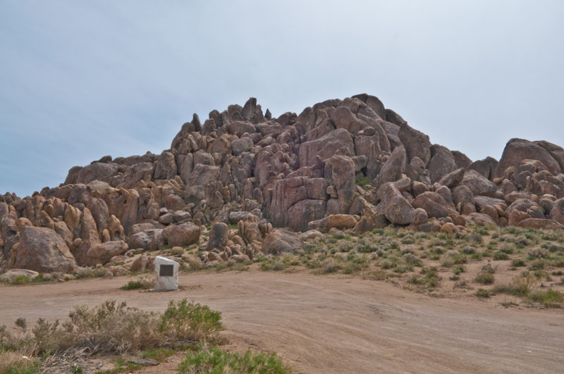
And here is one of the sites where the movie Gunga Din was filmed. The plaque mounted on the piece of white granite commemorates the making of the movie.
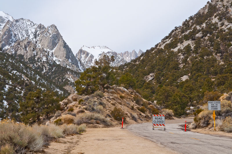
We drove up the Whitney Portal Road as far as we could, but it was still closed by snow. The Mount Whitney massif is in the far distance just right of center. The Mount Whitney summit is just out of view to the right. The jagged peaks of the massif that can be seen are called the Needles. It was the late afternoon and we began losing our light due to clouds coming in from the west.
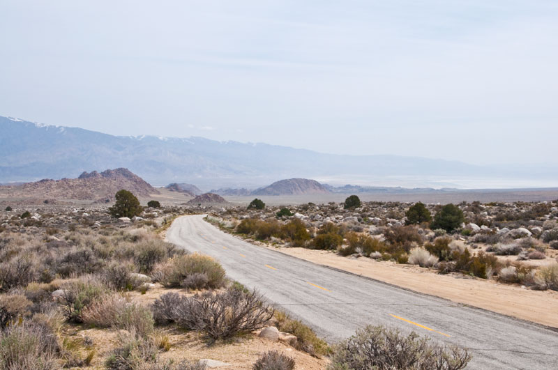
This was the view looking southwest from where we had to turn around on the Whitney Portal Road. The Alabama Hills are in the middle distance (Lone Pine is out of view behind them), the Inyo Mountains are in the background, and the Owens Lake can be seen in the distance to the right.
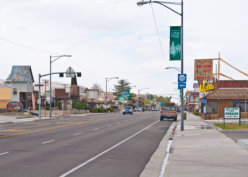
We stayed in Lone Pine, is not quite a one-horse town (as some have described it to me) as evident from the surprisingly heavy traffic that passes through on I395 (below), which is also the main street (and Main Street) in town. More accurately Lone Pine is a one street and one stoplight town, the one stoplight being at Whitney Portal Road (in the distance below). Watch out for the cops. The speed limit through town is 35 mph, a quick drop from 75 mph just outside of town. We watched many people pulled over for not slowing down fast enough. Here's a link to the excellent Lone Pine Chamber of Commerce website that has a lot of information on the area, things to do, places to eat, etc.: http://www.lonepinechamber.org/.
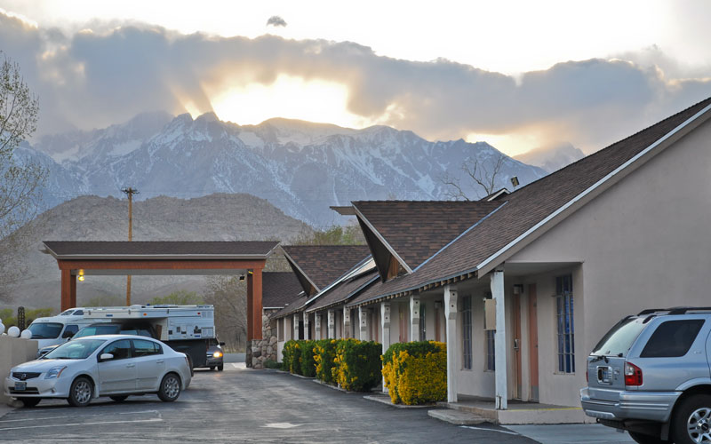
Denise captured this sunset over Mt. Whitney on our first evening in Lone Pine from our motel parking lot. Clouds began to come in from the west in the late afternoon, a precurser to the weather front that would eventually cause us to leave a day early. Mt. Whitney and the Needles are just left of center behind the setting sun. We stayed at the Best Western Frontier Motel on Main Street, which was quite nice and (I thought) a good value (http://www.bestwesterncalifornia.com/hotels/best-western-frontier-motel/).
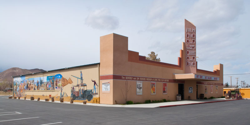
This is the Lone Pine Film History Museum (http://lonepinefilmhistorymuseum.org/content/) on Main Street. This is a must see if you have the time and you're interested in old films. We spent several hours there soaking up the history of early-Hollywood's westerns and other adventure films shot in the nearby Alabama Hills. And Hollywood is not yet finished with the Alabama Hills. The recent Iron Man movie (Marvel Studios 2008) was shot in part there.
![]()
![]()
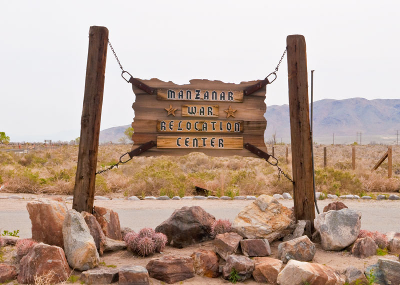
On our second day in the Owens Valley we drove to the Manzanar National Historic Site located about 10 miles north of Lone Pine on I395 (http://www.nps.gov/manz/index.htm). It is one of the 10 former war relocation centers where more than 110,000 Japanese Americans were interned in 1942 during World War 2. About 10,000 were interned at Manzanar. It is now administered by the National Park Service who is in the process of preserving and restoring parts of it. It serves "as a reminder to this and future generations of the fragility of American civil liberties", to quote the National Park Service website. A noble sentiment that is still apropos to our time.
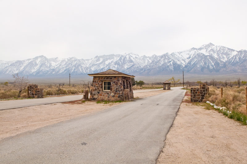
The original military police sentry posts still stand at the entrance to the site just off I395. They were built by Ryozo Kado, a stonemason interned in the camp. Mount Williamson, the second tallest mountain in the Sierra Nevada, stands in the distance on the right. A 3.2 mile self-guided driving tour through the camp begins here.
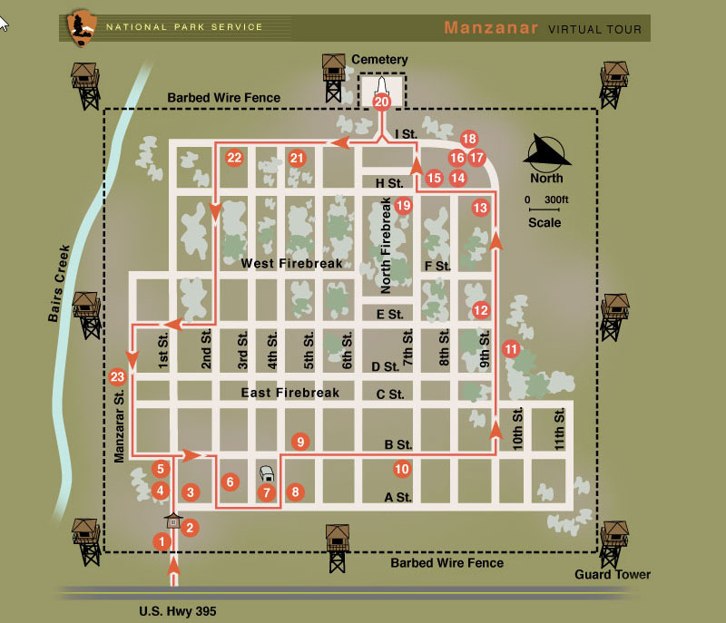
Here is the National Park Service Map of Manzanar War Relocation Center showing the self-guided auto tour route. The sites on the map below are described here: http://www.nps.gov/archive/manz/virtualtour/tour/map.html.
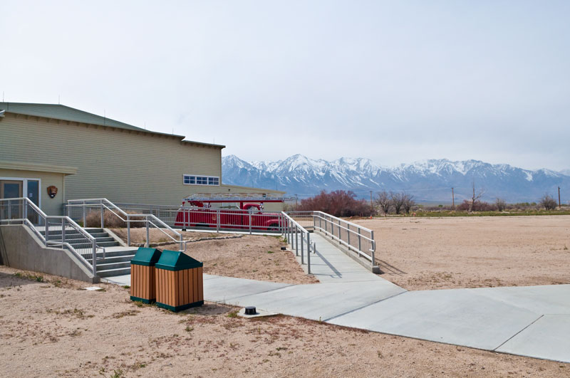
The entrance to the visitor center, located in the auditorium constructed by internees in 1943, is to the left. The remains of the camp extend behind the visitor center. The snow-covered Sierra Nevada Mountains rise in the background.
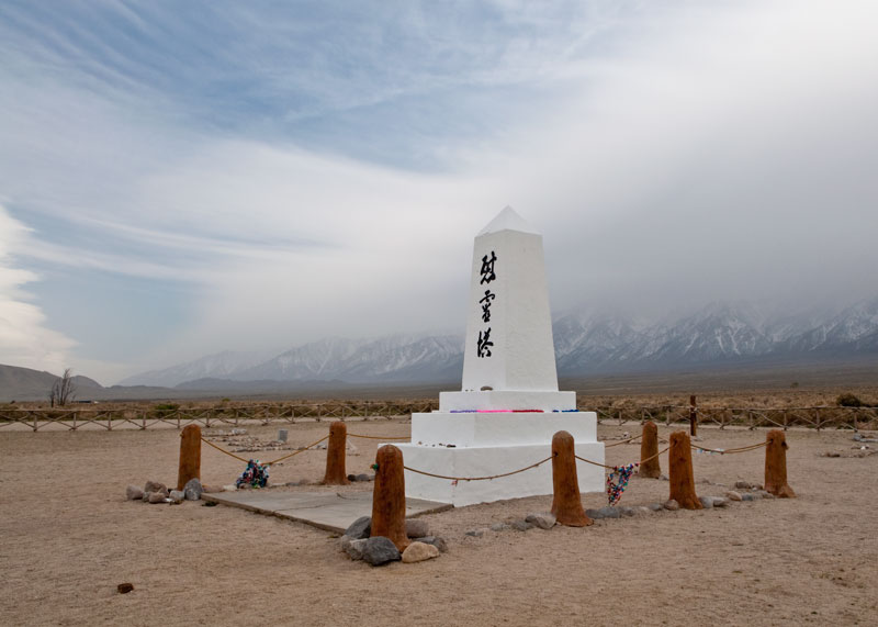
One of the moist poignant stops on the auto tour is the camp cemetery. The monument below was constructed by the stonemason Ryozo Kado and dedicated in August 1943. The inscription on the front reads, "Place of consolation for the spirit of all mankind". Approximately 80 people were buried here from 1942 through 1945, though only six remain today. The inscription on the back says, "Erected by the Manzanar Japanese, August 1943". The Annual Manzanar Pilgrimage meets here annually on the last Saturday of April.
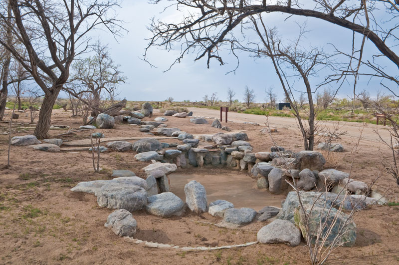
Other poignant reminders of the spirit of the people interned here are the remains of the water gardens they built amongst the military style barracks they lived in. The barracks are long gone, though the park is reconstructing a few for instructional purposes.
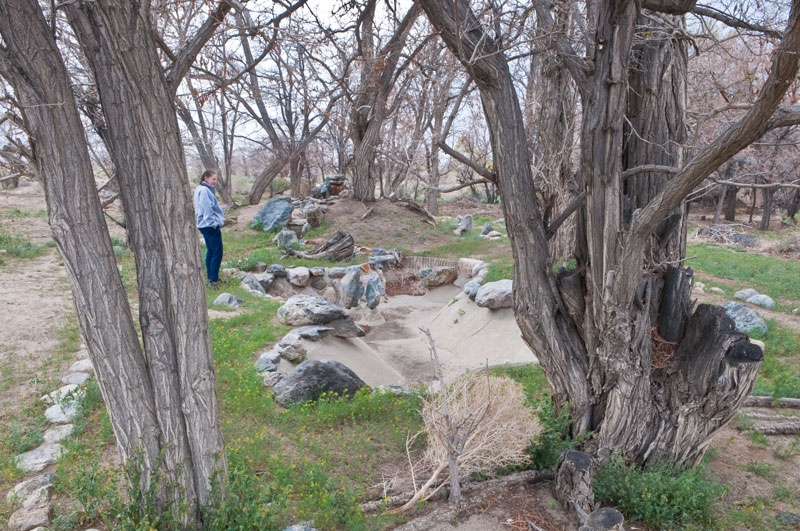
Here is the remains of another water garden. The trees that still grow here were planted by the Japanese-American internees.

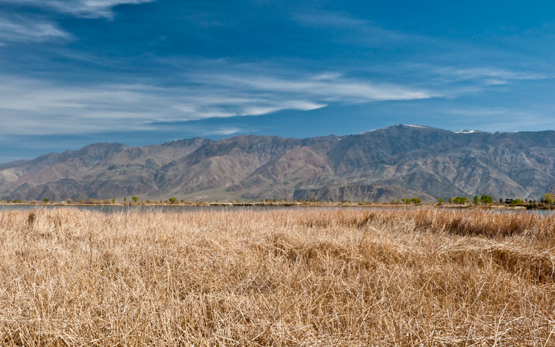
This image was taken from the extreme southwest corner of the camp looking northwest. The visitor center can be just seen on the horizon (below the Inyo Mountains) towards the right. The scrub is native and the land is very dry. The Owens Valley is known for its high winds and they were gusting this day as a cold front came in from the west. I was often sandblasted as I took these photos.
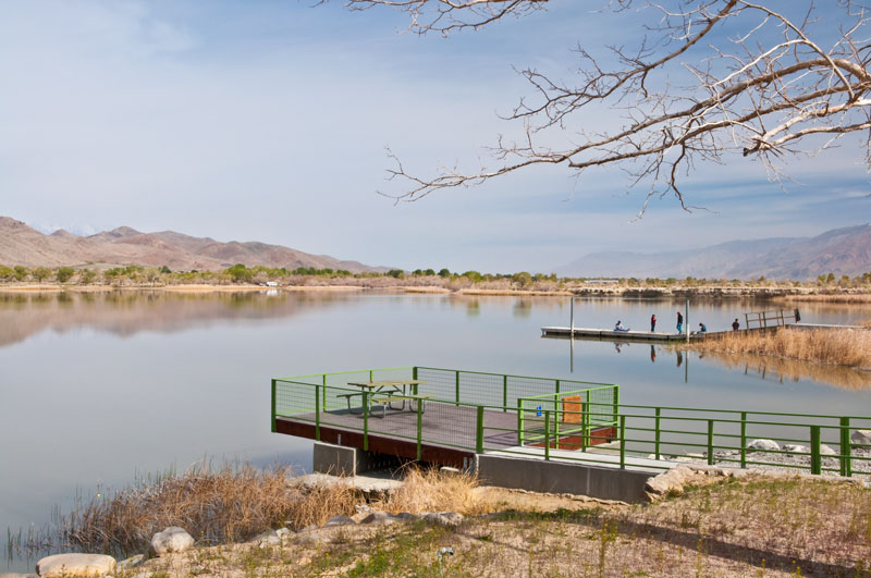
Lake Diaz is an excellent place to camp, fish and bird watch. It is located about 3 miles south of Lone Pine on I395. This photo shows one of the boat launches looking north up the Owens Valley. The Alabama Hills are to the left (the Sierra Nevada just barely visible behind them) and the Inyo Mountains to the right. Lake Diaz is administered by Inyo County: http://www.inyocountycamping.com/diaz_lake_campground.html.
Here we're looking northwest over Lake Diaz towards the Inyo Mountains. Keynot Peak is to the right of center with a bit of snow on its summit and Mt. Inyo is the less-well defined peak to the left of center in this image.
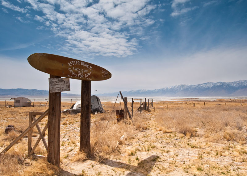
On our last morning in Owens Valley we drove down to the small town of Keeler on the east side of Owens Lake to get a look at the remains of the lake. Owens Lake is now nearly dry after the streams that fed it were diverted by the Los Angeles Department of Water and Power (LADWP) beginning in 1913. The lake was once about 30 ft deep and was renowned for its wildlife. It now contains only a small amount of water to help keep down the alkaline dust that blows north up into the valley on windy days per a court mandate. A local artist, Norm Hoffman, put up the sign in this photo. It reads, "Keeler Beach, Swim-Surf, Fish, Camps for Rent. Norm Hoffman. This beautiful setting provided by L.A. Water Dept." Obviously, the locals are still unhappy about Los Angeles taking the water. The dry lake can be seen in the background looking towards the southwest.
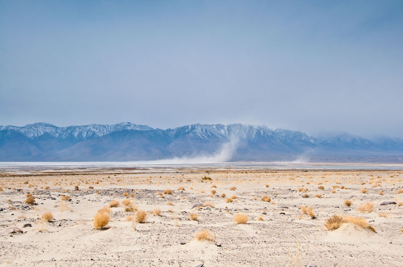
Here is another view of the Owens Lake looking west. A small amount of water can be seen in places. As we watched, a dust cloud rose from the dry lakebed and nearly obscured the 13,000 ft mountains behind it. As we drove back to Lone Pine the dust cloud seemed to follow us until it nearly obscured the sky. Yech!
This ends our adventure that began at the Joshua Tree National Park 10 days before. When we returned to Lone Pine from Owens Lake we discovered that a storm was headed in that could drop snow that evening on the Tehachapi Pass to the south and the Mammoth and Lee Vining regions to the north. After hearing this, we elected to head home a day early since we had to return to work. The next day I read that 4" of snow had fallen on Tehachapi. We were glad to be home.
![]()
![]()