Belgium: Leuven Brussels Ghent Bruges Antwerp
Brussels, Belgium - 2004
Brussels is the capital of Belgium and the center of government for the European Union, and is a very short train ride from Leuven, perhaps only 20 minutes, if I recall correctly. We visited Brussels a couple of times during our stay, arriving at the Central Train Station (Gar Centrale), just above the center of the map below. This put us within easy walking distance of all the historical sites and museums in the center of the old city.
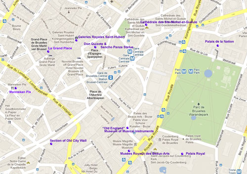
Click on the map above to see a larger version in a separate window. (Courtesy Google Maps.)
To the left is a map of the center of Brussels (courtesy of Google Maps). I marked the sites illustrated below with dots and their names.
Note that though both French and Dutch are the official languages of the Brussels-Capital Region, and street and other place signs are always in both languages. Below I generally used the French name for a site since it seemed to be the most commonly used language in Brussels, e.g., Bruxelles, unlike Dutch which is primarily spoken in the rest of Flanders.
The only exceptions are for places that are commonly known by their Dutch names, e.g., the Manneken Pis, or when I resorted to English because I couldn't recall all the French accent marks. And for that reason, I apologize up front if I've mispelled any French (or Dutch) site name.
Click on a thumbnail to see a larger image. Click on Next or Prev to move to the next image or to go back.
-
-
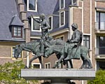
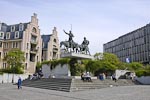
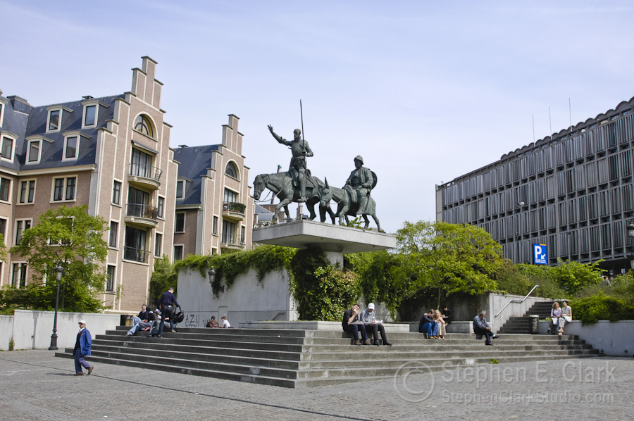
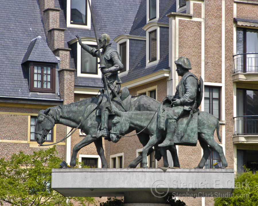
Walking west from the Central Train Station into the "Lower town", took us through the Place d'Espagne, the Spanish Square, where the Don Quixote & Sancho Panza Statue stands as a tribute to the great Spanish writer Miguel de Cervantes Saavedra.
-
-
-
-

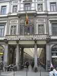
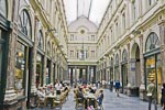
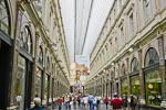
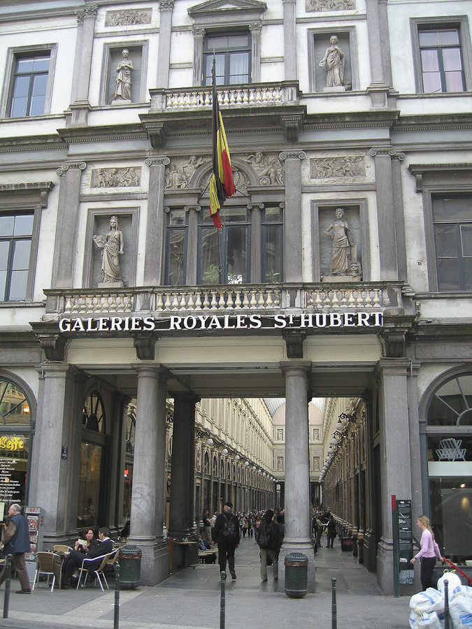
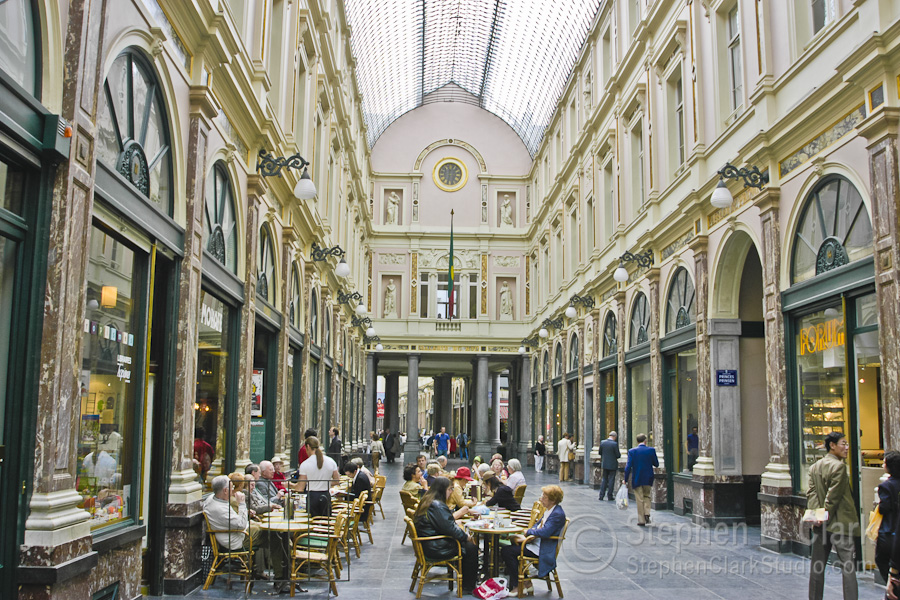
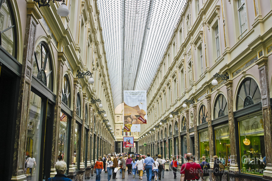
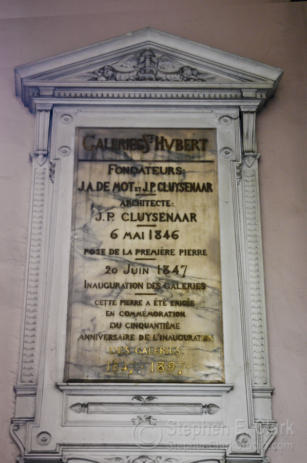
A few hundred feet further west is the Galeries Royales Saint-Hubert, one of the first covered shopping and dining arcades, inaugurated in 1847. We did some shopping, Denise bought a sun hat, and then we had a cup of tea and a light lunch before moving on. Note how the gallery bends beyond the colonnade at its center to relieve the tedium of its long, narrow perspective. (Photo of the Galeries entrance is from Le Bons Plans de Riquet, 13 April 2011).
-
-
-
-
-

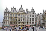
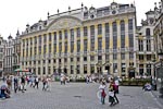
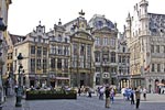
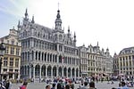
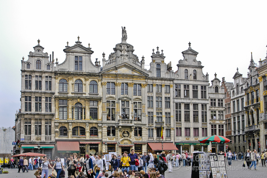
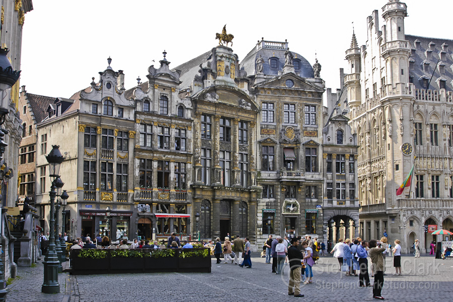
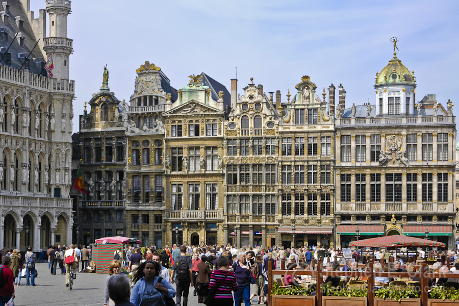
And within another few hundred feet one comes to La Grand Place, the cobblestoned medieval central market place of Brussels. The Grand Place is known for its ornate 17th century Flemish Renaissance architecture. From left to right above are a row of houses in the north-east corner of the square, La Maison des Ducs de Brabant (a group of six guild houses) in the south-east corner, a row of shops and restaurants along the south side, the towering Hôtel de Ville (the Brussels city town hall) in the south-west corner, and a row of shops and restaurants in the north-west corner.
-
-
-
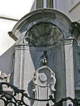
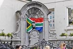
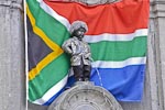
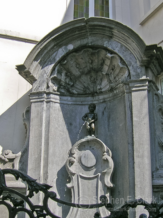
This little fellow is called the Manneken Pis and is located three blocks down the Rue de l'Étuve from the Grand Place and is apparently quite a tourist attraction judging from the crowd of people gathered about him (including ourselves). It is the statue of a young boy (only about 30 cm tall) peeing into a small pool. This statue is an 1818 reproduction of the original made in 1619, reputedly inspired by the son of a 12th century duke who was seen calmly urinating against a tree in the midst of a battle. By a tradition dating to 1698 the statue is usually dressed in the traditional garb of a country whose head of state made the costume donation. The Manneken Pis is shown in the first two photos wearing a costume donated by South Africa standing in front of its national flag. The third photo was taken on another visit at one of the rare times when the statue is not dressed. There are over 400 costumes for the Manneken Pis on display in the museum of the Hôtel de Ville.
-
-
-
-
-
-
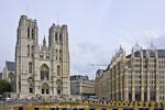
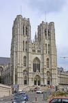
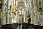
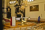
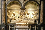
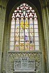
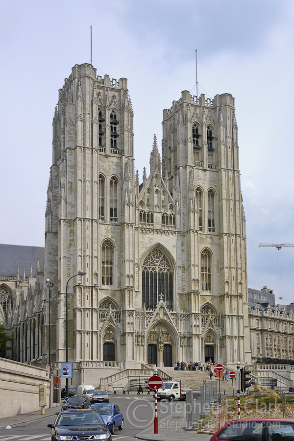
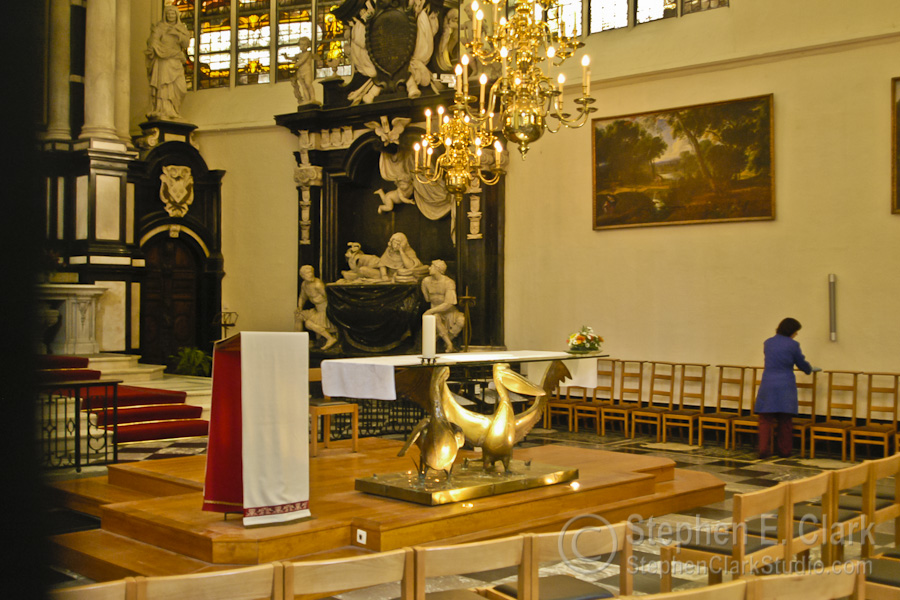
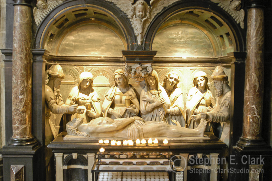
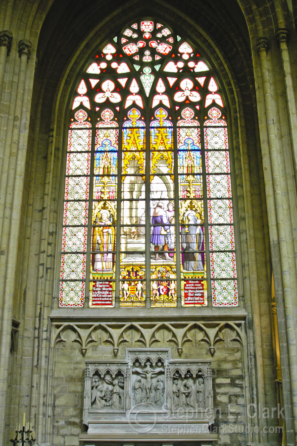
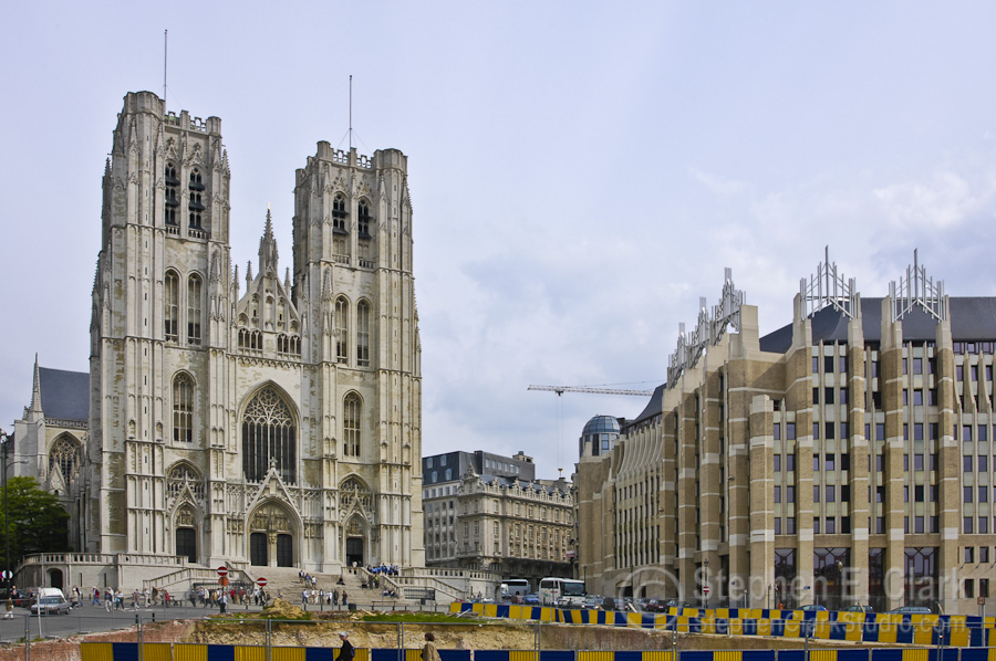
The Cathédrale des Sts-Michel-et-Gudule is the national church of Belgium and is considered the finest surviving example of Brabant Gothic architecture. Construction began in 1226 and continued for 300 years, finishing with the construction of the two front towers in the early 1600th century. The second photo looks down the central isle of the church from near the entrance. Note the gilded storks holding up the table near the lecturn. The stained glass windows were magnificent; this is from one of the transepts. The last picture juxteposes the cathedral to an adjacent office building under construction whose modern design is clearly inspired by the cathedral. I thought they looked cool side by side.
-
-
-
-
-

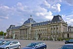
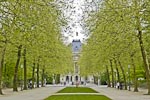
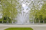
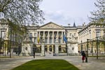
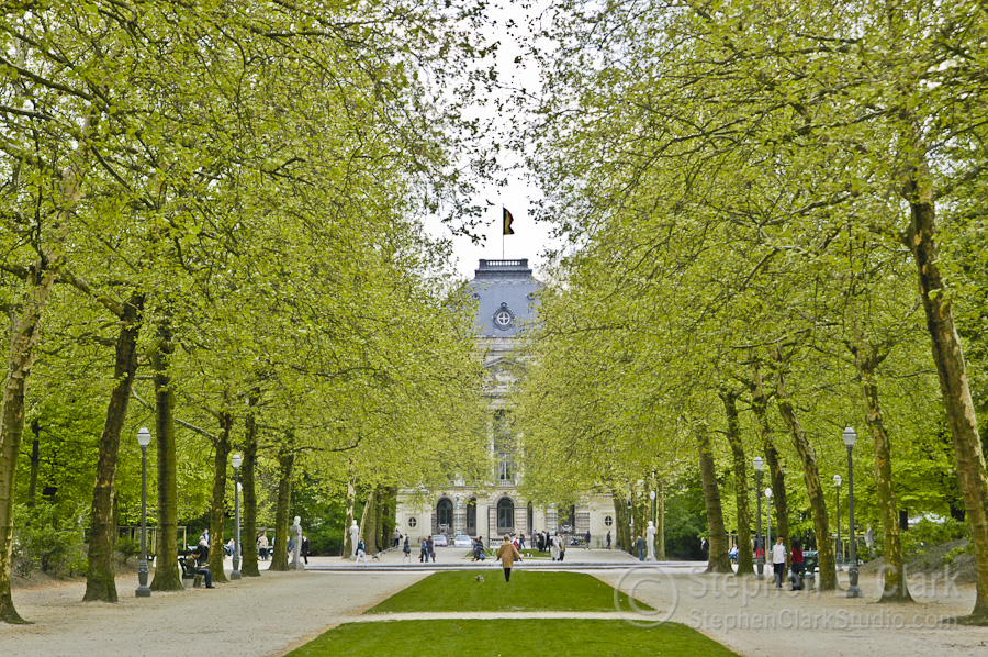
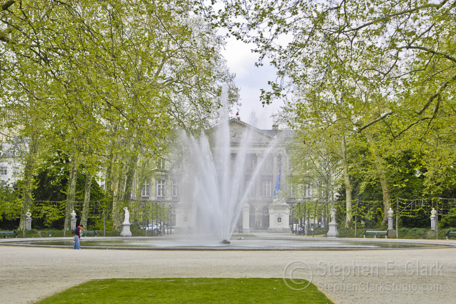
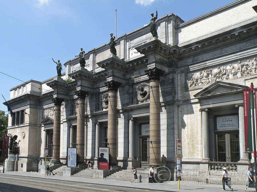
A short walk from the Central Train Station to the west, to the "Upper Town", takes one to the Royal Quarter: the Parc de Bruxelles, the Palais Royal (official home of the Belgium royal family), the Palais de la Nation (home of the national parliment), the fine art museum and other spectacular 18th and 19th century neo-classical buildings. From left to right are the Palais Royal with its flag flying, indicating that the sovereign is in residence, the Palais Royal seen through the trees of Brussels Park, the Palais de la Nation seen in the opposite direction through Brussels Park, a closer view of the Palais de la Nation, and the Musées Royaux des Beaux-Arts that opens onto the Place Royale. We spent a lot of time in the Musées Royaux des Beaux-Arts, which contains both ancient (defined as 15th to 18th centuries) and modern (19th century to the present) art, but unfortunately photography wasn't allowed inside so I have no pictures of the masterpieces we saw.
-
-
-
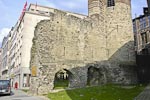
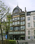
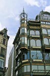
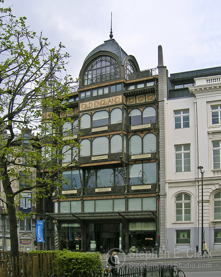
Walking back to the train station, less than a block from the Place Royale, we passed the "Old England" building on the Rue Montagne de la Cour, which looked so interesting and out of place that I took several photos. I later learned that this was once a department store by the name of Old England, built in 1899, that is now houses the Museé Instrumental. What is remarkable about it is its Art Nouveau architecture comprised of entirely of glass and wrought iron. It is considered one of the finest examples of that style. The rightmost picture is of a section of the original city wall that dates to the 11th or 12th century, somehome surviving all that time intact. It is located on the south side of the Boulevard de l'Empereur, a couple blocks south of the Central Train Station.


Fifty kilometers to the west by train is the port city of Ghent.
Belgium: Leuven Brussels Ghent Bruges Antwerp
![]()
![]()